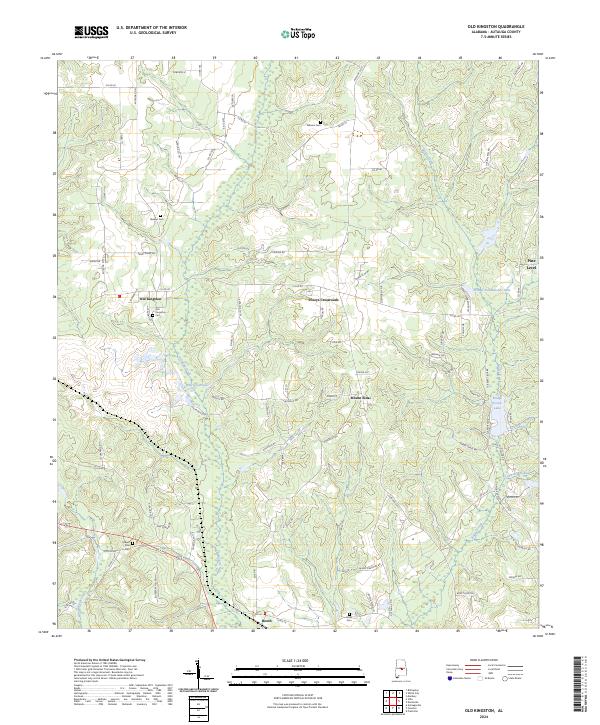
2024 Map of Old Kingston
USGS Topo · Published 2024About this map
Old Kingston and the surrounding Autauga County countryside are defined by a network of creeks and small settlements in this recent survey. The landscape is deeply tied to its local heritage, evidenced by several family and community burial grounds such as Stewart Cem, Wilsons Cem, and the Old Kingston Cem. The drainage patterns of Autauga Creek and Mill Creek shape the terrain, which transitions from the clustered homes at Poseys Crossroads and Mount Sinai to the more open spaces near Booth.
Find a feature on this map
89 named features on this map. Tap any name to fly to it.
Don’t see what you’re looking for? This feature index may not catch every label — zoom into the map to look around manually.
Map Details
Editions of this 2024 Old Kingston Map
This is the sole edition of this map. No revisions or reprints were ever made.
Other maps of this area

1891 · Clanton
USGS Topo · 1:125,000

1901 · Wetumpka
USGS Topo · 1:125,000

1903 · Wetumpka
USGS Topo · 1:125,000

1927 · Montgomery
USGS Topo · 1:48,000

1930 · Montgomery
USGS Topo · 1:62,500

1953 · Montgomery
USGS Topo · 1:250,000

1956 · Montgomery
USGS Topo · 1:250,000

1957 · Montgomery
USGS Topo · 1:250,000

1957 · Autaugaville
USGS Topo · 1:62,500

1958 · Montgomery
USGS Topo · 1:62,500