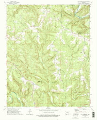
1973 Map of Old Lexington
USGS Topo · Published 1975About this map
The Middle Fork Little Red River snakes through the northern reaches of this Ozark landscape, marking a terrain defined by steep ridges and deep hollows. Settlement patterns follow the winding creek beds and narrow gaps between elevations like Half Moon Mountain and Clinton Mountain. The map centers on the small communities of Old Lexington and Old Botkinburg, where local life is anchored by country churches including Corinth Ch and Plant Ch.
Find a feature on this map
50 named features on this map. Tap any name to fly to it.
Don’t see what you’re looking for? This feature index may not catch every label — zoom into the map to look around manually.
Map Details
Editions of this 1973 Old Lexington Map
2 editions found
Other maps of this area

1892 · Marshall
USGS Topo · 1:125,000

1892 · Mountain View
USGS Topo · 1:125,000

1894 · Mountain View
USGS Topo · 1:125,000

1894 · Marshall
USGS Topo · 1:125,000

1901 · Marshall
USGS Topo · 1:125,000

1956 · Russellville
USGS Topo · 1:250,000

1963 · Leslie
USGS Topo · 1:24,000

1964 · Russellville
USGS Topo · 1:250,000
1965 · Botkinburg
USGS Topo · 1:24,000
1965 · Scotland
USGS Topo · 1:24,000