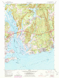
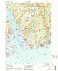
1958 Map of Old Lyme
USGS Topo · Published 1980About this map
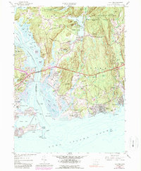
The Connecticut River marks a historic transition from the coastal village of Old Saybrook across to Old Lyme, where the Raymond E Baldwin Bridge and the Penn Central railroad span the water. This mid-century landscape is defined by the tidal marshes and numerous islands at the river's mouth, including Great Island and Goose Island. Inland, the map reveals a network of country roads such as Bill Lane and Mile Creek Road leading to family landmarks like Lord Hill and established cemeteries including Duck River Cem. The shoreline of the Long Island Sound is dotted with seasonal communities like White Sands Beach and Sound View, while the eastern portion is dominated by the Stone Ranch Military Reservation and the extensive grounds of Rocky Neck State Park, illustrating the balance between military use, public recreation, and historic shoreline settlement.
Find a feature on this map
149 named features on this map. Tap any name to fly to it.
Don’t see what you’re looking for? This feature index may not catch every label — zoom into the map to look around manually.
Map Details
Editions of this 1958 Old Lyme Map
6 editions found
Other maps of this area

1892 · New London
USGS Topo · 1:62,500

1893 · New London
USGS Topo · 1:62,500

1893 · Saybrook
USGS Topo · 1:62,500

1903 · Gardiners Island
USGS Topo · 1:62,500

1904 · Gardiners Island
USGS Topo · 1:62,500

1921 · Gardiners Island
USGS Topo · 1:62,500

1921 · New London
USGS Topo · 1:62,500

1934 · Niantic
USGS Topo · 1:24,000

1935 · Montville
USGS Topo · 1:24,000

1938 · Niantic
USGS Topo · 1:62,500