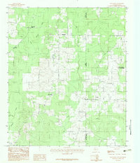
1983 Map of Old Panola
USGS Topo · Published 1983About this map
The borderlands of East Texas and Louisiana are defined by the winding paths of Socagee Creek and Mill Creek in this 1983 field study. The landscape is marked by small rural communities like Old Panola and Shiloh, where the social fabric of the era is anchored by landmarks such as Shiloh Ch and Shiloh Cem. To the north, the settlement of Centennial features its own Centennial Ch and Centennial Cem, suggesting a long-standing residential pattern centered on these parish-line churches.
Find a feature on this map
20 named features on this map. Tap any name to fly to it.
Don’t see what you’re looking for? This feature index may not catch every label — zoom into the map to look around manually.
Map Details
Editions of this 1983 Old Panola Map
This is the sole edition of this map. No revisions or reprints were ever made.
Other maps of this area

1943 · Waskom
USGS Topo · 1:62,500

1945 · Grand Cane
USGS Topo · 1:62,500

1945 · Waskom
USGS Topo · 1:62,500

1945 · Greenwood
USGS Topo · 1:62,500

1945 · Socagee Bayou
USGS Topo · 1:62,500

1955 · Shreveport
USGS Topo · 1:250,000

1955 · Greenwood
USGS Topo · 1:62,500

1956 · Shreveport
USGS Topo · 1:250,000

1956 · Tyler
USGS Topo · 1:250,000

1956 · Deadwood
USGS Topo · 1:62,500