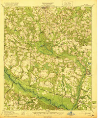
1920 Map of Oliver
USGS Topo · Published 1920About this map
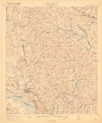
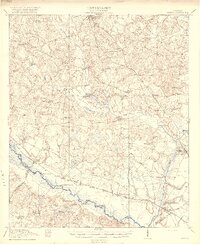
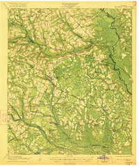
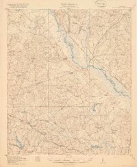
The Ogeechee River carves a winding path through this corner of Georgia, defining the boundary between Screven, Bulloch, and Effingham counties in 1920. This landscape is a dense network of early 20th-century rural infrastructure, where life centered around the Central of Georgia railroad and the numerous schools that dotted the countryside, such as Middle Ground School and Gilgal School. The map reveals a river-based economy still in transition, evidenced by named river access points like Opies Landing and Hendersons Landing. Local social life is anchored by a cluster of country houses of worship, including Double Head Church and Lee Memorial Church. Travelers of the era moved between settlements like Newington and Halcyondale via the historic Louisville Road and Savannah Road, crossing the wetlands of Long Branch and Black Creek over timber structures like Mccall Bridge and Nelson Bridge.
Find a feature on this map
54 named features on this map. Tap any name to fly to it.
Don’t see what you’re looking for? This feature index may not catch every label — zoom into the map to look around manually.
Map Details
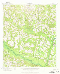
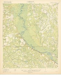
Editions of this 1920 Oliver Map
2 editions found
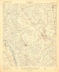
Other maps of this area
1918 · Oliver
USGS Topo · 1:62,500
1919 · Shirley
USGS Topo · 1:62,500
1919 · Egypt
USGS Topo · 1:62,500

1920 · Statesboro
USGS Topo · 1:62,500

1920 · Hilltonia
USGS Topo · 1:62,500
1920 · Millen
USGS Topo · 1:62,500
1920 · Oliver
USGS Topo · 1:62,500

1920 · Peeples
USGS Topo · 1:62,500
1921 · Brooklet
USGS Topo · 1:62,500
1921 · Rocky Ford
USGS Topo · 1:62,500