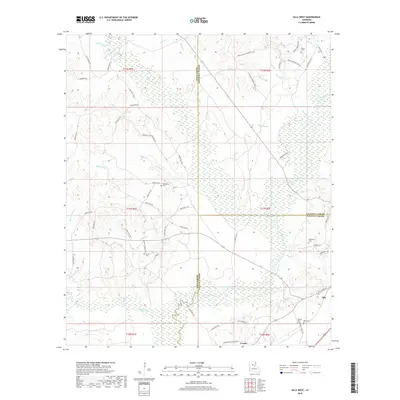
2018 Map of Olla West
USGS Topo · Published 2018About this map
Olla and Urania anchor the southeastern corner of this 2018 survey, where the borders of LaSalle, Winn, and Caldwell Parishes converge. The landscape is defined by an intricate network of waterways, including Castor Creek, Sandy Cr, and Crooked Cr, which meander through the low-lying terrain typical of North Central Louisiana. For genealogists and local historians, the map is remarkably dense with family-named landmarks and resting places, from the Adams Cem in the north to Whitehead Cem and Nelson Cem centrally located near Delphit Br. The presence of the L & Pacific Rd and numerous parish roads, such as Parish Rd 1169 and Parish Rd 738, trace the legacy of the local timber and rail infrastructure that once drove the regional economy.
Find a feature on this map
71 named features on this map. Tap any name to fly to it.
Don’t see what you’re looking for? This feature index may not catch every label — zoom into the map to look around manually.
Map Details
Editions of this 2018 Olla West Map
This is the sole edition of this map. No revisions or reprints were ever made.
Other maps of this area

1940 · Columbia
USGS Topo · 1:62,500

1953 · Alexandria
USGS Topo · 1:250,000

1954 · Sikes
USGS Topo · 1:62,500

1954 · Tullos
USGS Topo · 1:62,500

1955 · Shreveport
USGS Topo · 1:250,000

1955 · Alexandria
USGS Topo · 1:250,000

1955 · Olla
USGS Topo · 1:62,500

1956 · Shreveport
USGS Topo · 1:250,000

1957 · Columbia
USGS Topo · 1:62,500

1984 · Shreveport
USGS Topo · 1:250,000