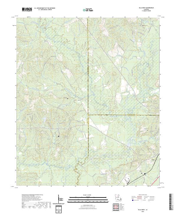
2024 Map of Olla West
USGS Topo · Published 2024About this map
Winn, Caldwell, and LaSalle parishes meet in this timber-heavy corridor of North Central Louisiana. The town of Olla anchors the southeastern corner, serving as a gateway to the dense network of hunting clubs and parish roads that weave through the pine-covered lowlands. The landscape is defined by its drainages, where Castor Creek and Richland Creek cut through the terrain alongside numerous branches and creeks that feed into larger regional basins. For researchers, this 2024 map provides a comprehensive view of family-named landmarks and rural burial grounds, including the Nelson, Adams, and McBroom cemeteries, which are connected by a web of local routes such as Adams Cemetery Rd 619 and Nelson Cemetary Rd. The map also captures the industrial footprint of the region with access points like La Pacific Rd, reflecting the area's ongoing connection to forestry and land management.
Find a feature on this map
72 named features on this map. Tap any name to fly to it.
Don’t see what you’re looking for? This feature index may not catch every label — zoom into the map to look around manually.
Map Details
Editions of this 2024 Olla West Map
This is the sole edition of this map. No revisions or reprints were ever made.
Other maps of this area

1940 · Columbia
USGS Topo · 1:62,500

1953 · Alexandria
USGS Topo · 1:250,000

1954 · Sikes
USGS Topo · 1:62,500

1954 · Tullos
USGS Topo · 1:62,500

1955 · Shreveport
USGS Topo · 1:250,000

1955 · Alexandria
USGS Topo · 1:250,000

1955 · Olla
USGS Topo · 1:62,500

1956 · Shreveport
USGS Topo · 1:250,000

1957 · Columbia
USGS Topo · 1:62,500

1984 · Shreveport
USGS Topo · 1:250,000