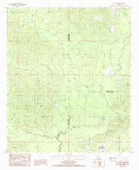
1984 Map of Olla West
USGS Topo · Published 1985About this map
Castor Creek and its many winding tributaries define the topography of this central Louisiana landscape during the mid-1980s. The area is a dense network of hydrologic features, where minor waterways like Piney Branch and Yellow Jacket Creek drain into larger systems. The map captures the convergence of three parishes—Winn, Caldwell, and La Salle—marked by surveyed boundaries that cut across the timbered terrain. While primarily rural and focused on natural drainage basins, the inclusion of Richland provides a specific point of geographic orientation for those tracing local land use or family holdings in this corner of the state. The complex drainage patterns, including Flat Creek and Crooked Creek, illustrate the low-lying, water-dependent nature of the local environment before more modern development altered these traditional boundaries and watercourses.
Find a feature on this map
21 named features on this map. Tap any name to fly to it.
Don’t see what you’re looking for? This feature index may not catch every label — zoom into the map to look around manually.
Map Details
Editions of this 1984 Olla West Map
This is the sole edition of this map. No revisions or reprints were ever made.
Other maps of this area

1940 · Columbia
USGS Topo · 1:62,500

1953 · Alexandria
USGS Topo · 1:250,000

1954 · Sikes
USGS Topo · 1:62,500

1954 · Tullos
USGS Topo · 1:62,500

1955 · Shreveport
USGS Topo · 1:250,000

1955 · Alexandria
USGS Topo · 1:250,000

1955 · Olla
USGS Topo · 1:62,500

1956 · Shreveport
USGS Topo · 1:250,000

1957 · Columbia
USGS Topo · 1:62,500

1984 · Shreveport
USGS Topo · 1:250,000