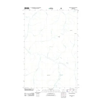
2011 Map of Olson Peak
USGS Topo · Published 2011About this map
Olson Peak and Galusha Peak dominate the high terrain of Lewis and Clark County in this 2011 survey, marking a landscape defined by its complex drainage systems. The northern portion is carved by the North Fork Blackfoot River, while the southern reaches are fed by the East Fork North Fork Blackfoot River and its numerous tributaries. This area is characterized by high-elevation water bodies like Twin Lakes and Meadow Lake, which collect runoff from the surrounding slopes of Bugle Mountain and Red Ridge.
Find a feature on this map
21 named features on this map. Tap any name to fly to it.
Don’t see what you’re looking for? This feature index may not catch every label — zoom into the map to look around manually.
Map Details
Editions of this 2011 Olson Peak Map
This is the sole edition of this map. No revisions or reprints were ever made.
Other maps of this area

1903 · Coopers Lake
USGS Topo · 1:125,000

1955 · Choteau
USGS Topo · 1:250,000

1957 · Choteau
USGS Topo · 1:250,000

1958 · Choteau
USGS Topo · 1:250,000

1962 · Choteau
USGS Topo · 1:250,000

1968 · Heart Lake
USGS Topo · 1:24,000

1968 · Olson Peak
USGS Topo · 1:24,000
1968 · Coopers Lake
USGS Topo · 1:24,000
1968 · Stonewall Mountain
USGS Topo · 1:24,000
1968 · Lake Mountain
USGS Topo · 1:24,000