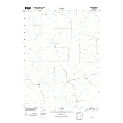
2012 Map of Omaha
USGS Topo · Published 2012About this map
Omaha and the surrounding rural landscapes of Putnam County, Missouri, and southern Iowa are meticulously documented in this 2012 survey. The area is defined by a dense network of country roads, such as Co HWY-211 and Co HWY-180, which connect small settlements like Chariton and Esper. A significant number of burial grounds, including Zoar Cemetery, Union Cemetery, and Friendship Cemetery, are scattered across the terrain, serving as vital landmarks for genealogists and local historians tracing family lineages in this border region.
Find a feature on this map
68 named features on this map. Tap any name to fly to it.
Don’t see what you’re looking for? This feature index may not catch every label — zoom into the map to look around manually.
Map Details
Editions of this 2012 Omaha Map
This is the sole edition of this map. No revisions or reprints were ever made.
Other maps of this area

1911 · Queen City
USGS Topo · 1:62,500

1912 · Green City
USGS Topo · 1:62,500

1913 · Queen City
USGS Topo · 1:62,500

1914 · Green City
USGS Topo · 1:62,500

1939 · Centerville
USGS Topo · 1:62,500

1941 · Centerville
USGS Topo · 1:62,500

1954 · Centerville
USGS Topo · 1:250,000

1957 · Centerville
USGS Topo · 1:250,000

1958 · Centerville
USGS Topo · 1:250,000
1974 · Green City NW
USGS Topo · 1:24,000