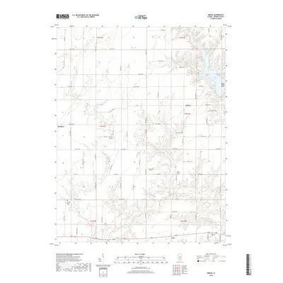
2018 Map of Omega
USGS Topo · Published 2018About this map
Omega and Brubaker anchor the rural landscape of Marion County in this late 2010s survey. The area is defined by a dense network of country roads, including Omega Rd and Brubaker Rd, which weave between creek systems like Dums Cr and Mountain Br. For the local historian or genealogist, the map is particularly rich in family-named burial sites, including the Millican Cem and Lovells Grove Cem in the east, and Summit Prairie Cem to the west. Recreational features are concentrated along the shores of Forbes Lake at Rocky Point Beach, while smaller water bodies like Boston Lake and Neffs Lake dot the township divisions. The map provides a precise look at the 2018 township and range lines, showing how modern county highways intersect with established rural settlements and their surrounding tributaries.
Find a feature on this map
74 named features on this map. Tap any name to fly to it.
Don’t see what you’re looking for? This feature index may not catch every label — zoom into the map to look around manually.
Map Details
Editions of this 2018 Omega Map
This is the sole edition of this map. No revisions or reprints were ever made.
Other maps of this area
1934 · Salem
USGS Topo · 1:62,500
1938 · Salem
USGS Topo · 1:62,500
1945 · Kinmundy
USGS Topo · 1:62,500
1947 · Kinmundy
USGS Topo · 1:62,500
1952 · Xenia
USGS Topo · 1:62,500
1956 · Edgewood
USGS Topo · 1:62,500
1958 · Belleville
USGS Topo · 1:250,000
1962 · Belleville
USGS Topo · 1:250,000
1965 · Iuka
USGS Topo · 1:24,000
1965 · Salem South
USGS Topo · 1:24,000