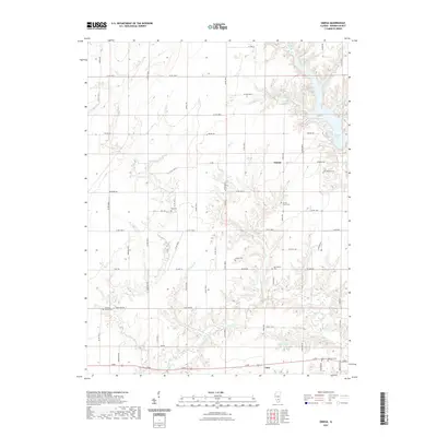
2021 Map of Omega
USGS Topo · Published 2021About this map
Omega and the northern edge of Iuka anchor this Marion County landscape, defined by a dense network of creek drainages and rural cemeteries that map generations of family history. The terrain is dissected by numerous waterways including Dums Cr, Bee Branch, and Tadlock Br, creating a topography that has historically shaped the placement of farmsteads and roads. Notable for genealogists are the many small burial grounds preserved across the townships, such as Yost Cem, Millican Cem, and Lovells Grove Cem. Along the eastern margin, the waters of Forbes Lake and Boston Lake illustrate the area's modern hydrography. The map provides a detailed view of the section-line road system, including Prairie Rd and Brubaker Rd, which connect these dispersed settlements and historical sites in the southern Illinois interior.
Find a feature on this map
41 named features on this map. Tap any name to fly to it.
Don’t see what you’re looking for? This feature index may not catch every label — zoom into the map to look around manually.
Map Details
Editions of this 2021 Omega Map
This is the sole edition of this map. No revisions or reprints were ever made.
Other maps of this area

1934 · Salem
USGS Topo · 1:62,500

1938 · Salem
USGS Topo · 1:62,500

1945 · Kinmundy
USGS Topo · 1:62,500

1947 · Kinmundy
USGS Topo · 1:62,500

1952 · Xenia
USGS Topo · 1:62,500

1956 · Edgewood
USGS Topo · 1:62,500

1958 · Belleville
USGS Topo · 1:250,000

1962 · Belleville
USGS Topo · 1:250,000

1965 · Iuka
USGS Topo · 1:24,000
1965 · Salem South
USGS Topo · 1:24,000