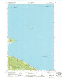
1968 Map of Onamia NW
USGS Topo · Published 1986About this map
Mille Lacs Lake dominates this 1960s survey, illustrating the complex bathymetry of its southwestern basin and the specialized preservation areas along its shores. The map details the transition from the open waters of the lake into Vineland Bay, bordered by the forested grounds of Mille Lacs Kathio State Park. Inland, the landscape is dotted with smaller water bodies like Black Bass Lake and Tamarac Lake, which are characteristic of the region's glacial legacy.
Find a feature on this map
12 named features on this map. Tap any name to fly to it.
Don’t see what you’re looking for? This feature index may not catch every label — zoom into the map to look around manually.
Map Details
Editions of this 1968 Onamia NW Map
2 editions found
Other maps of this area

1912 · Deerwood
USGS Topo · 1:62,500

1914 · Deerwood
USGS Topo · 1:62,500

1916 · Wealthwood
USGS Topo · 1:62,500

1953 · Duluth
USGS Topo · 1:250,000

1958 · Duluth
USGS Topo · 1:250,000

1968 · Onamia NW
USGS Topo · 1:24,000

1968 · Onamia
USGS Topo · 1:24,000

1968 · Wahkon North
USGS Topo · 1:24,000
1968 · Vineland
USGS Topo · 1:24,000
1968 · Wahkon South
USGS Topo · 1:24,000