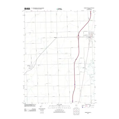
2012 Map of Onarga West
USGS Topo · Published 2012About this map
The village of Onarga and the nearby settlement of Thawville anchor this 2012 survey of the Illinois prairie. The landscape is defined by a strictly organized grid of agricultural roads, including E 1600 N RD and N 300 E RD, which slice through the flat terrain typical of Iroquois County. Small waterways like Prairie Cr and Spring Cr meander through the farmland, providing the only break in the geometric road pattern. For local historians and genealogists, the map preserves the locations of several burial grounds, including Onarga Cem, Thawville Cem, and the more isolated Lisk Cem. The presence of the Post Office in Onarga and the cluster of residential streets such as S Wood ST in Thawville show the enduring layout of these rural communities in the early twenty-first century.
Find a feature on this map
51 named features on this map. Tap any name to fly to it.
Don’t see what you’re looking for? This feature index may not catch every label — zoom into the map to look around manually.
Map Details
Editions of this 2012 Onarga West Map
This is the sole edition of this map. No revisions or reprints were ever made.
Other maps of this area

1939 · Cissna Park
USGS Topo · 1:62,500

1944 · Piper City
USGS Topo · 1:48,000

1944 · Gilman
USGS Topo · 1:62,500

1946 · Gilman
USGS Topo · 1:62,500

1947 · Piper City
USGS Topo · 1:62,500

1948 · Buckley
USGS Topo · 1:62,500

1949 · Cissna Park
USGS Topo · 1:62,500

1949 · Buckley
USGS Topo · 1:62,500

1953 · Danville
USGS Topo · 1:250,000

1955 · Danville
USGS Topo · 1:250,000