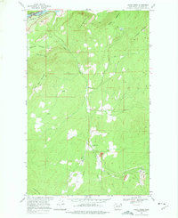
1969 Map of Onion Creek
USGS Topo · Published 1975About this map
The Van Stone Mine and its associated Tailings and Tailings Pond dominate the southeastern industrial landscape of this Stevens County region. High-relief terrain defines the area, with peaks like Bodie Mountain and Staghorn Mtn rising above the winding drainage of Onion Creek. The rural social center is marked by the Onion Creek Sch, located at a bend in the creek where it meets the West Fork Onion Creek.
Find a feature on this map
26 named features on this map. Tap any name to fly to it.
Don’t see what you’re looking for? This feature index may not catch every label — zoom into the map to look around manually.
Map Details
Editions of this 1969 Onion Creek Map
3 editions found
Other maps of this area

1929 · Colville
USGS Topo · 1:125,000

1933 · Colville
USGS Topo · 1:125,000

1952 · Gillette Mtn
USGS Topo · 1:24,000

1952 · Spirit
USGS Topo · 1:24,000

1952 · Echo Valley
USGS Topo · 1:24,000

1952 · Boundary
USGS Topo · 1:24,000

1952 · Aladdin
USGS Topo · 1:24,000

1958 · Sandpoint
USGS Topo · 1:250,000

1963 · Sandpoint
USGS Topo · 1:250,000
1966 · Aladdin
USGS Topo · 1:24,000