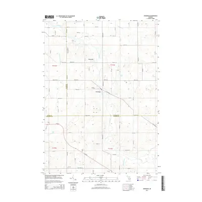
2014 Map of Onondaga
USGS Topo · Published 2014About this map
The Grand River snakes through this portion of Ingham, Eaton, and Jackson Counties, serving as a primary geographical anchor for the settlements of Onondaga and Kinneville. This 2014 survey reveals a landscape deeply rooted in its rural township structure, where old roads like Old Plank Rd and Clinton Rd intersect a grid of family-named lanes and agricultural tracts. The area is notable for its numerous burial grounds, including the Onondaga Cem and the Pope Cem, which often sit near historical church sites or family homesteads. To the south, the terrain becomes more water-heavy near Sandstone Creek and Fuller Lake, while several drainage systems like the N Onondaga Drain and Higgins Drain highlight the engineered management of the low-lying basin. The map captures the quiet transition of these mid-Michigan townships as they maintained their agricultural character into the early 21st century.
Find a feature on this map
52 named features on this map. Tap any name to fly to it.
Don’t see what you’re looking for? This feature index may not catch every label — zoom into the map to look around manually.
Map Details
Editions of this 2014 Onondaga Map
This is the sole edition of this map. No revisions or reprints were ever made.
Other maps of this area

1909 · Mason
USGS Topo · 1:62,500

1910 · Lansing
USGS Topo · 1:62,500

1911 · Mason
USGS Topo · 1:62,500

1912 · Lansing
USGS Topo · 1:62,500

1919 · Springport
USGS Topo · 1:62,500

1919 · Rives Junction
USGS Topo · 1:62,500

1921 · Rives Junction
USGS Topo · 1:62,500

1921 · Springport
USGS Topo · 1:62,500

1958 · Grand Rapids
USGS Topo · 1:250,000

1961 · Grand Rapids
USGS Topo · 1:250,000