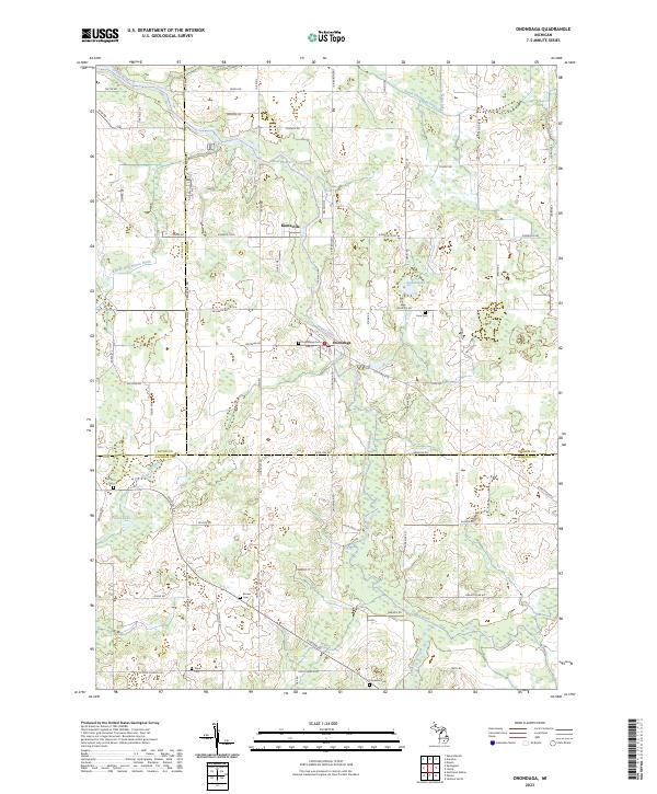
2023 Map of Onondaga
USGS Topo · Published 2023About this map
The Grand River snakes through this rural landscape where the boundaries of Ingham, Eaton, and Jackson counties converge. The settlement of Onondaga serves as a central point, situated just south of the older community of Kinneville. The area's agricultural and social history is etched into the terrain through a high concentration of small burial grounds, including Lane Cem, Onondaga Cem, and the Pope Cem further south. Modern recreational use of the waterway is noted by the Upper Grand River Water Trl, which follows the river's winding course. This recent survey reflects the persistent rural character of the region, where legacy farm roads like Old Plank Rd and Baseline Rd still define the township divisions. The presence of numerous small water bodies such as Lanes Lake and Fuller Lake punctuates the low-lying areas near the river's edge, highlighting the drainage patterns of the Sandstone Creek and Otter Creek systems.
Find a feature on this map
74 named features on this map. Tap any name to fly to it.
Don’t see what you’re looking for? This feature index may not catch every label — zoom into the map to look around manually.
Map Details
Editions of this 2023 Onondaga Map
This is the sole edition of this map. No revisions or reprints were ever made.
Other maps of this area

1909 · Mason
USGS Topo · 1:62,500

1910 · Lansing
USGS Topo · 1:62,500

1911 · Mason
USGS Topo · 1:62,500

1912 · Lansing
USGS Topo · 1:62,500

1919 · Springport
USGS Topo · 1:62,500

1919 · Rives Junction
USGS Topo · 1:62,500

1921 · Rives Junction
USGS Topo · 1:62,500

1921 · Springport
USGS Topo · 1:62,500

1958 · Grand Rapids
USGS Topo · 1:250,000

1961 · Grand Rapids
USGS Topo · 1:250,000