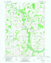
1981 Map of Onondaga
USGS Topo · Published 1981About this map
The Grand River carves a winding path through this Ingham County landscape, defining the rural development around Onondaga and Kinneville. In the early 1980s, the region shows a mix of agricultural tradition and specialized land use, ranging from the Onondaga Oil Field in the north to the Onondaga Dragway and Highfields Community Boys Camp further south. The transportation network is anchored by Conrail tracks and local routes like Kinneville Road and Ballard Highway.
Find a feature on this map
46 named features on this map. Tap any name to fly to it.
Don’t see what you’re looking for? This feature index may not catch every label — zoom into the map to look around manually.
Map Details
Editions of this 1981 Onondaga Map
This is the sole edition of this map. No revisions or reprints were ever made.
Other maps of this area

1909 · Mason
USGS Topo · 1:62,500

1910 · Lansing
USGS Topo · 1:62,500

1911 · Mason
USGS Topo · 1:62,500

1912 · Lansing
USGS Topo · 1:62,500

1919 · Springport
USGS Topo · 1:62,500

1919 · Rives Junction
USGS Topo · 1:62,500

1921 · Rives Junction
USGS Topo · 1:62,500

1921 · Springport
USGS Topo · 1:62,500

1958 · Grand Rapids
USGS Topo · 1:250,000

1961 · Grand Rapids
USGS Topo · 1:250,000