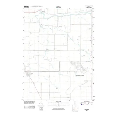
2010 Map of Onward
USGS Topo · Published 2010About this map
Wabash River frontage and the sprawling residential layout of Grissom Air Force Base define this Cass County landscape. The 2010 survey highlights a transition from the dense street grid of Walton and the Walton Post Office to the broad, agricultural expanses around Onward. A complex drainage network, including Government Ditch, Dry Run Ditch, and Phillips Ditch, underscores the region's managed hydrology, supporting both the military installations and rural farmland. For local historians, the map preserves the locations of several burial grounds, including Bowyer Cemetery near Pipe Creek and Garnand Cemetery. Aviation history is well-represented, with the runways of Grissom Air Force Base dominating the southeast and the smaller Headland Airport situated near Rock Creek.
Find a feature on this map
49 named features on this map. Tap any name to fly to it.
Don’t see what you’re looking for? This feature index may not catch every label — zoom into the map to look around manually.
Map Details
Editions of this 2010 Onward Map
This is the sole edition of this map. No revisions or reprints were ever made.
Other maps of this area

1951 · Peru
USGS Topo · 1:24,000

1951 · Onward
USGS Topo · 1:24,000

1951 · Twelve Mile
USGS Topo · 1:24,000

1951 · Bunker Hill
USGS Topo · 1:24,000

1953 · Danville
USGS Topo · 1:250,000

1955 · Danville
USGS Topo · 1:250,000

1955 · Logansport
USGS Topo · 1:24,000

1955 · Anoka
USGS Topo · 1:24,000

1956 · Danville
USGS Topo · 1:250,000

1959 · Galveston
USGS Topo · 1:24,000