1972 Map of Onyx
USGS Topo · Published 1976About this map
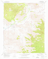
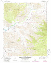
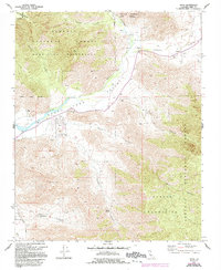
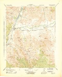
The South Fork Valley serves as a vital corridor for settlement and agriculture in the early 1970s, as shown by the network of working ranches and residential pockets. The settlement of Onyx is the focal point of the area, supported by the Onyx Ranch and proximity to Scodie Park. This region demonstrates a high concentration of family and community history, evidenced by the presence of both the Cottage Grove Cem and an Indian Cem, marking the layered heritage of the valley.
Find a feature on this map
28 named features on this map. Tap any name to fly to it.
Don’t see what you’re looking for? This feature index may not catch every label — zoom into the map to look around manually.
Map Details
Editions of this 1972 Onyx Map
3 editions found
Other maps of this area

1906 · Kernville
USGS Topo · 1:125,000

1908 · Kernville
USGS Topo · 1:125,000
1943 · Onyx
USGS Topo · 1:62,500
1943 · Isabella
USGS Topo · 1:62,500

1948 · Bakersfield
USGS Topo · 1:250,000

1955 · Bakersfield
USGS Topo · 1:250,000

1956 · Bakersfield
USGS Topo · 1:250,000
1956 · Kernville
USGS Topo · 1:62,500
1956 · Lamont Peak
USGS Topo · 1:62,500

1960 · Bakersfield
USGS Topo · 1:250,000