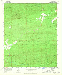
1968 Map of Onyx
USGS Topo · Published 1970About this map
Onyx and Aly stand as the primary settlements within this 1968 landscape, dominated by the heavily timbered ridges of the Ouachita National Forest. The geography is defined by prominent peaks including Allen Peak, which features a lookout tower, and the long ridgeline of Bear Head Mountain. Waterways like the Fourche La Fave River and South Fourche Creek carve through the terrain, joined by numerous smaller streams such as Holland Branch and Durrough Creek. Local history is preserved in sites like the Ballew Cem and Keener Cem, while the Onyx Trail suggests historical transit routes through the hollows. The presence of fine red dashed lines on the map indicating selected fence and field lines provides a unique layer of data for researchers tracking historical land use and property boundaries in this part of Yell County.
Find a feature on this map
44 named features on this map. Tap any name to fly to it.
Don’t see what you’re looking for? This feature index may not catch every label — zoom into the map to look around manually.
Map Details
Editions of this 1968 Onyx Map
2 editions found
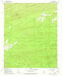
Other maps of this area

1890 · Mount Ida
USGS Topo · 1:125,000

1890 · Hot Springs
USGS Topo · 1:125,000

1894 · Hot Springs
USGS Topo · 1:125,000

1955 · Little Rock
USGS Topo · 1:250,000

1956 · Little Rock
USGS Topo · 1:250,000

1959 · Mount Ida
USGS Topo · 1:62,500

1960 · Little Rock
USGS Topo · 1:250,000

1960 · Gravelly
USGS Topo · 1:62,500

1962 · Avant
USGS Topo · 1:24,000

1962 · Fannie
USGS Topo · 1:24,000