2024 Map of Opelousas
USGS Topo · Published 2024About this map
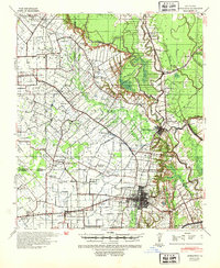
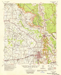
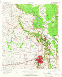
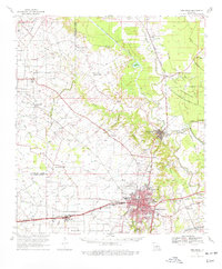
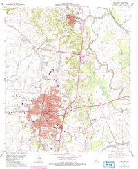
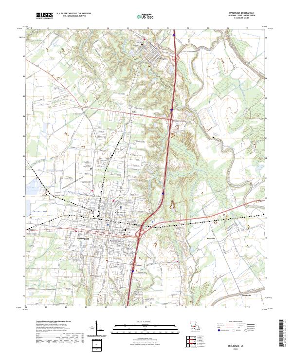
Opelousas and the nearby town of Washington anchor this landscape where the prairies of St. Landry Parish meet a complex network of waterways. The topography is defined by the winding paths of Bayou Courtableau, Bayou Teche, and Bayou Bellevue, which historically served as vital corridors for the region's agricultural trade. In this modern survey, the dense concentration of cemeteries—including Saint Landry Cem, the historic Hebrew Rest Cem, and Cedar Hill Cem—speaks to the deep generational roots and local heritage of the area. The map illustrates the civic layout of the parish seat, centered on the Saint Landry Parish Courthouse, while showing the growth of outward settlements like Nuba, Boscoville, and Notelyville. The transition from urban street grids to the surrounding bayous reveals a community still oriented toward its natural water systems even as modern transport like the St Landry Parish Airport and major highways shape the contemporary landscape.
Find a feature on this map
185 named features on this map. Tap any name to fly to it.
Don’t see what you’re looking for? This feature index may not catch every label — zoom into the map to look around manually.
Map Details
Editions of this 2024 Opelousas Map
This is the sole edition of this map. No revisions or reprints were ever made.
Historical Maps of Opelousas Through Time
6 maps found