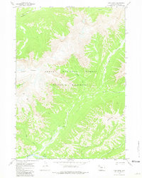
1970 Map of Open Creek
USGS Topo · Published 1981About this map
The Teton National Forest and Washakie Wilderness dominate this high-altitude landscape, recorded through aerial photography in 1969 and field-checked in 1970. The terrain is defined by a dense network of mountain waterways, including the winding course of Open Creek and its many tributaries like Silvertip Creek and Scatter Creek. These drainages carve through prominent geological formations such as Petrified Ridge and the Trident Plateau, which is bounded by a sharp Escarpment. The isolation of the area is evident in the reliance on the Pack Trail system for navigation, which follows the natural contours of the valleys and ridgelines. The convergence of Thorofare Creek and Mountain Creek at the southern and northern boundaries respectively illustrates the complex hydrological layout of this protected wilderness area before modern satellite mapping became standard.
Find a feature on this map
16 named features on this map. Tap any name to fly to it.
Don’t see what you’re looking for? This feature index may not catch every label — zoom into the map to look around manually.
Map Details
Editions of this 1970 Open Creek Map
2 editions found
Other maps of this area

1885 · Lake
USGS Topo · 1:125,000

1893 · Ishawooa
USGS Topo · 1:125,000

1895 · Ishawooa
USGS Topo · 1:125,000

1895 · Lake
USGS Topo · 1:125,000

1896 · Lake
USGS Topo · 1:125,000

1899 · Ishawooa
USGS Topo · 1:125,000

1901 · Lake
USGS Topo · 1:125,000

1906 · Lake
USGS Topo · 1:125,000

1911 · Lake
USGS Topo · 1:125,000

1955 · Ashton
USGS Topo · 1:250,000