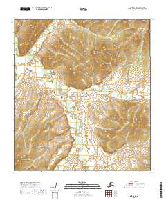
2019 Map of Ophir B-1 NE
USGS Topo · Published 2019About this map
S Fork Folger Cr and its various tributaries define this interior Alaska landscape within the Yukon-Koyukuk region. This 2019 survey documents a complex network of high-elevation drainages, where the headwaters of Folger Creek and Dominion Cr cut through the upland terrain. The map provides a detailed view of the natural watercourses such as Butte Cr, Canyon Cr, and Kimbley Cr, which represent the primary landmarks in an area otherwise defined by its remote topography. The grid of the Public Land Survey System, including townships t23s r14e and t24s r15e, is overlaid on these natural features, reflecting the systematic mapping of the Alaskan wilderness long after the initial gold rush eras of the region. This data serves as a precise record of the stream paths and elevation contours in a territory where the landscape itself is the principal feature.
Find a feature on this map
10 named features on this map. Tap any name to fly to it.
Don’t see what you’re looking for? This feature index may not catch every label — zoom into the map to look around manually.
Map Details
Editions of this 2019 Ophir B-1 NE Map
This is the sole edition of this map. No revisions or reprints were ever made.
Other maps of this area

1950 · Medfra
USGS Topo · 1:250,000

1951 · Ophir
USGS Topo · 1:250,000

1954 · Medfra C-6
USGS Topo · 1:63,360

1954 · Medfra B-6
USGS Topo · 1:63,360

1954 · Ophir C-1
USGS Topo · 1:63,360

1954 · Ophir B-1
USGS Topo · 1:63,360

1954 · Ophir
USGS Topo · 1:250,000

1959 · Medfra
USGS Topo · 1:250,000
2019 · Medfra C-6 SW
USGS Topo · 1:25,000
2019 · Ophir B-1 SE
USGS Topo · 1:25,000