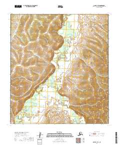
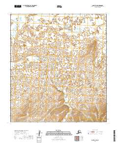
2019 Map of Ophir C-1 SW
USGS Topo · Published 2019About this map
The Innoko River meanders extensively through this portion of the Yukon-Koyukuk Census Area, creating a complex network of oxbows and marshlands characteristic of the Alaskan interior. This 2019 survey documents a landscape defined by its riparian corridors, where the primary river is joined by numerous tributaries including Folger Creek and Caribou Cr as they flow out of the higher elevations in the eastern and western ranges. The terrain shows a distinct contrast between the broad, saturated river valley and the rising slopes marked by Fourmile Cr and Tutomile Cr. This map is particularly useful for understanding the modern hydrology and natural drainage patterns of this remote region, which remains largely devoid of modern road infrastructure or named settlements, preserving a snapshot of the wilderness as it exists today.
Find a feature on this map
13 named features on this map. Tap any name to fly to it.
Don’t see what you’re looking for? This feature index may not catch every label — zoom into the map to look around manually.
Map Details
Editions of this 2019 Ophir C-1 SW Map
This is the sole edition of this map. No revisions or reprints were ever made.
Other maps of this area

1951 · Ophir
USGS Topo · 1:250,000

1954 · Ophir C-1
USGS Topo · 1:63,360

1954 · Ophir C-2
USGS Topo · 1:63,360

1954 · Ophir B-1
USGS Topo · 1:63,360

1954 · Ophir B-2
USGS Topo · 1:63,360

1954 · Ophir
USGS Topo · 1:250,000
1965 · Ophir B-2
USGS Topo · 1:63,360
2019 · Ophir C-1 NE
USGS Topo · 1:25,000
2019 · Ophir B-1 NE
USGS Topo · 1:25,000
2019 · Ophir C-2 NE
USGS Topo · 1:25,000