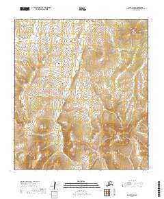
2019 Map of Ophir C-2 SE
USGS Topo · Published 2019About this map
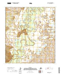
Scandinavian Cr and Fourmile Cr define the drainage patterns of this interior Alaskan landscape within the Yukon-Koyukuk region. The terrain is marked by significant elevation changes, with the northern and southern portions of the sheet rising toward unnamed high points, while the central valleys follow the winding paths of the primary creeks. This 2019 survey, produced by the U.S. Geological Survey, details the township and range boundaries including t21s r11e, t22s r11e, and t23s r12e. The absence of roads, structures, or established settlements emphasizes the remote, undeveloped character of this territory, which remains dominated by natural topographical features and the seasonal flow of its tributary systems.
Find a feature on this map
8 named features on this map. Tap any name to fly to it.
Don’t see what you’re looking for? This feature index may not catch every label — zoom into the map to look around manually.
Map Details
Editions of this 2019 Ophir C-2 SE Map
This is the sole edition of this map. No revisions or reprints were ever made.
Other maps of this area

1951 · Ophir
USGS Topo · 1:250,000

1954 · Ophir C-1
USGS Topo · 1:63,360

1954 · Ophir C-2
USGS Topo · 1:63,360

1954 · Ophir B-1
USGS Topo · 1:63,360

1954 · Ophir B-2
USGS Topo · 1:63,360

1954 · Ophir
USGS Topo · 1:250,000
1965 · Ophir B-2
USGS Topo · 1:63,360
2019 · Ophir C-2 SW
USGS Topo · 1:25,000
2019 · Ophir C-2 NE
USGS Topo · 1:25,000
2019 · Ophir C-2 NW
USGS Topo · 1:25,000