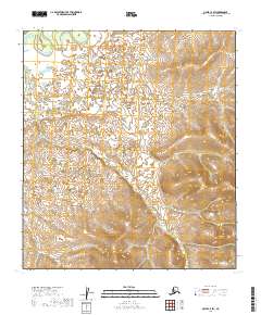
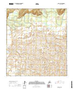
2019 Map of Ophir C-2 SW
USGS Topo · Published 2019About this map
The interior Alaska landscape within the t22s r10e and t23s r11e townships reveals a terrain defined by subtle drainage patterns and significant elevation shifts. Flowing through the northern reaches, Doctor Beaver Cr meanders across a relatively flat basin, while the central and southern portions of the map are drained by Finland Cr and Taft Cr. The survey illustrates the transition from low-lying wetlands and creek beds to more prominent uplands in the east and south, where contour lines tighten significantly. This area, part of the Yukon-Koyukuk region, shows no established settlements or infrastructure, highlighting the primitive state of this remote interior territory at the time of the survey.
Find a feature on this map
9 named features on this map. Tap any name to fly to it.
Don’t see what you’re looking for? This feature index may not catch every label — zoom into the map to look around manually.
Map Details
Editions of this 2019 Ophir C-2 SW Map
This is the sole edition of this map. No revisions or reprints were ever made.
Other maps of this area

1951 · Ophir
USGS Topo · 1:250,000

1954 · Ophir C-3
USGS Topo · 1:63,360

1954 · Ophir C-2
USGS Topo · 1:63,360

1954 · Ophir B-2
USGS Topo · 1:63,360

1954 · Ophir B-3
USGS Topo · 1:63,360

1954 · Ophir
USGS Topo · 1:250,000
1965 · Ophir B-2
USGS Topo · 1:63,360
2017 · Ophir C-3 NE
USGS Topo · 1:25,000
2017 · Ophir B-3 NE
USGS Topo · 1:25,000
2017 · Ophir C-3 SE
USGS Topo · 1:25,000