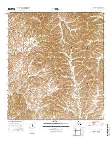
2015 Map of Ophir C-6 NW
USGS Topo · Published 2015About this map
The Kaiyuh Mountains dominate this landscape within the Yukon-Koyukuk region, revealing a complex network of high ridges and drainage basins. A primary waterway here is Menoti Cr, which winds through the central and southern sections of the terrain. The topography is defined by the sharp elevations of the Kaiyuh range, showing how the land slopes away from these peaks toward the creek valleys. This 2015 survey by the U.S. Geological Survey provides a clear look at the township and range boundaries including t21s r1w and t20s r1w, offering a precise view of this interior Alaskan wilderness before further contemporary changes.
Find a feature on this map
8 named features on this map. Tap any name to fly to it.
Don’t see what you’re looking for? This feature index may not catch every label — zoom into the map to look around manually.
Map Details
Editions of this 2015 Ophir C-6 NW Map
This is the sole edition of this map. No revisions or reprints were ever made.
Other maps of this area

1951 · Ophir
USGS Topo · 1:250,000

1951 · Unalakleet
USGS Topo · 1:250,000

1952 · Unalakleet C-1
USGS Topo · 1:63,360

1952 · Unalakleet D-1
USGS Topo · 1:63,360

1952 · Unalakleet
USGS Topo · 1:250,000
1954 · Ophir D-6
USGS Topo · 1:63,360

1954 · Ophir C-6
USGS Topo · 1:63,360

1954 · Ophir
USGS Topo · 1:250,000

1964 · Unalakleet
USGS Topo · 1:250,000
2014 · Ophir C-6 SE
USGS Topo · 1:25,000