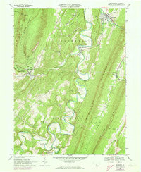
1966 Map of Orbisonia
USGS Topo · Published 1973About this map
The East Broad Top RR winds through the narrow valleys of Huntingdon County, anchoring the historic sister boroughs of Orbisonia and Rockhill. This 1966 survey, updated with 1973 revisions, reveals a landscape defined by the parallel ridges of Jacks Mountain, Shopes Ridge, and Blacklog Mountain. The meandering path of Aughwick Creek serves as a central artery for small communities like Pogue and Maddensville, where the presence of the McKendree Ch and Walnut Grove Ch suggest long-established rural social hubs.
Find a feature on this map
60 named features on this map. Tap any name to fly to it.
Don’t see what you’re looking for? This feature index may not catch every label — zoom into the map to look around manually.
Map Details
Editions of this 1966 Orbisonia Map
3 editions found
Other maps of this area

1901 · Huntingdon
USGS Topo · 1:62,500

1904 · Huntingdon
USGS Topo · 1:62,500

1922 · Mt Union
USGS Topo · 1:48,000

1924 · Mt. Union
USGS Topo · 1:62,500

1930 · Broad Top
USGS Topo · 1:62,500

1933 · Broad Top
USGS Topo · 1:62,500

1939 · Orbisonia
USGS Topo · 1:62,500

1940 · Orbisonia
USGS Topo · 1:62,500

1944 · Orbisonia
USGS Topo · 1:62,500

1944 · Mt. Union
USGS Topo · 1:62,500