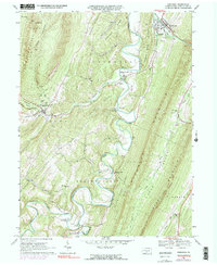
1966 Map of Orbisonia
USGS Topo · Published 1990About this map
Orbisonia and the adjacent borough of Rockhill serve as the primary hubs in this mid-1960s study of Huntingdon County. The narrow-gauge heritage of the East Broad Top RR is central to the landscape, with rail lines and an abandoned grade tracing the valleys near Blacklog Creek. To the west, the village of Three Springs sits at the confluence of several gaps, while the southern reaches follow the winding path of Aughwick Creek toward Maddensville and Meadow Gap.
Find a feature on this map
51 named features on this map. Tap any name to fly to it.
Don’t see what you’re looking for? This feature index may not catch every label — zoom into the map to look around manually.
Map Details
Editions of this 1966 Orbisonia Map
3 editions found
Other maps of this area

1901 · Huntingdon
USGS Topo · 1:62,500

1904 · Huntingdon
USGS Topo · 1:62,500

1922 · Mt Union
USGS Topo · 1:48,000

1924 · Mt. Union
USGS Topo · 1:62,500

1930 · Broad Top
USGS Topo · 1:62,500

1933 · Broad Top
USGS Topo · 1:62,500

1939 · Orbisonia
USGS Topo · 1:62,500

1940 · Orbisonia
USGS Topo · 1:62,500

1944 · Orbisonia
USGS Topo · 1:62,500

1944 · Mt. Union
USGS Topo · 1:62,500