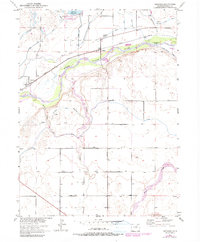
1951 Map of Orchard
USGS Topo · Published 1979About this map
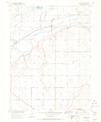
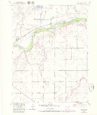
The South Platte River valley defines this mid-century agricultural landscape in Morgan County, where complex irrigation networks supported the local economy. The towns of Orchard and Goodrich serve as primary hubs along the Union Pacific rail line, which parallels the river. This survey highlights the critical water infrastructure of the era, from the massive Jackson Reservoir and its State Recreation Area in the north to the Fort Morgan Canal Headgate on the river's southern bank.
Find a feature on this map
19 named features on this map. Tap any name to fly to it.
Don’t see what you’re looking for? This feature index may not catch every label — zoom into the map to look around manually.
Map Details
Editions of this 1951 Orchard Map
7 editions found
Other maps of this area

1950 · Wiggins
USGS Topo · 1:24,000

1950 · Greasewood Lake
USGS Topo · 1:24,000

1950 · Masters
USGS Topo · 1:24,000

1951 · Masters
USGS Topo · 1:24,000

1951 · Weldona
USGS Topo · 1:24,000

1951 · Orchard
USGS Topo · 1:24,000

1951 · Sunken Lake
USGS Topo · 1:24,000

1951 · Omar
USGS Topo · 1:24,000

1951 · Judson Hills
USGS Topo · 1:24,000

1954 · Sterling
USGS Topo · 1:250,000