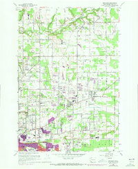
1961 Map of Orchards
USGS Topo · Published 1972About this map
The Burlington Northern corridor anchors this portrait of Clark County's evolving landscape, where the northern reaches of Vancouver transition into the orchards and fields of the North Plain. The settlement pattern is defined by historic centers like Brush Prairie and Orchards, alongside smaller nodes at Barberton and Sifton. This 1961 survey, updated with 1970 aerial photography, captures a pivotal era of suburban expansion.
Find a feature on this map
42 named features on this map. Tap any name to fly to it.
Don’t see what you’re looking for? This feature index may not catch every label — zoom into the map to look around manually.
Map Details
Editions of this 1961 Orchards Map
4 editions found
Other maps of this area

1897 · Portland
USGS Topo · 1:62,500

1905 · Portland
USGS Topo · 1:62,500

1918 · Troutdale
USGS Topo · 1:62,500

1934 · Troutdale
USGS Topo · 1:48,000

1940 · Portland
USGS Topo · 1:62,500

1940 · La Center
USGS Topo · 1:62,500

1941 · Yacolt
USGS Topo · 1:62,500

1941 · Camas
USGS Topo · 1:62,500

1942 · Camas
USGS Topo · 1:62,500

1948 · Vancouver
USGS Topo · 1:250,000