
1954 Map of Ord NE
USGS Topo · Published 1955About this map
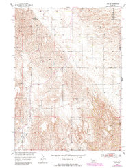
The Nebraska prairie of Valley County is defined by a dense network of local education centers in the mid-1950s. This survey records an era of rural school districts, naming scattered landmarks such as Plain Valley Sch, Clearview Sch, and Brick Sch. The landscape is a mix of agricultural terrain and drainage basins, with Elm Creek, Messenger Creek, and Spring Creek carving through the plains. Numerous Windmill sites are marked throughout the townships, indicating the importance of groundwater for the farmsteads that once populated this region. The map also includes the meeting of several county lines, including the borders of Garfield, Wheeler, and Greeley counties. These features, combined with sites like Noble Sch and Spring View Sch, offer a clear picture of the community infrastructure and land use in the Missouri River Basin during the mid-twentieth century.
Find a feature on this map
19 named features on this map. Tap any name to fly to it.
Don’t see what you’re looking for? This feature index may not catch every label — zoom into the map to look around manually.
Map Details
Editions of this 1954 Ord NE Map
2 editions found
Other maps of this area

1954 · Ord SE
USGS Topo · 1:24,000

1954 · Ord
USGS Topo · 1:24,000

1954 · Gables SE
USGS Topo · 1:24,000

1954 · Gables SW
USGS Topo · 1:24,000

1954 · Horace
USGS Topo · 1:24,000

1954 · Ord NW
USGS Topo · 1:24,000

1954 · Greeley NW
USGS Topo · 1:24,000

1954 · Ericson
USGS Topo · 1:24,000

1955 · Broken Bow
USGS Topo · 1:250,000

1956 · Broken Bow
USGS Topo · 1:250,000