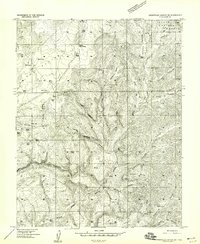
1957 Map of Orderville Canyon NE
USGS Topo · Published 1959About this map
The North Fork Virgin River carves a deep path through this portion of Kane County, defining a landscape dominated by dramatic vertical relief and complex drainages. Within the Dixie National Forest, the map reveals a stark contrast between high, flat-topped features like The Plain and Table Bench and the narrow, winding corridors of Orderville Canyon and Straight Canyon. Numerous seasonal water sources, including Lower Bear Spring and Upper Bear Spring, suggest the critical importance of water management for cattle in this arid environment, further evidenced by the frequent marking of Stock Tanks. A network of Jeep Trails and unnamed trails provides the only access through this dissected terrain, connecting remote points like Millet Point and Bullock Canyon to the wider region. The map captures the area before modern development, showing it as a dedicated ranching and forest landscape.
Find a feature on this map
27 named features on this map. Tap any name to fly to it.
Don’t see what you’re looking for? This feature index may not catch every label — zoom into the map to look around manually.
Map Details
Editions of this 1957 Orderville Canyon NE Map
2 editions found
Other maps of this area

1886 · Kanab
USGS Topo · 1:250,000

1953 · Cedar City
USGS Topo · 1:250,000

1954 · Orderville Canyon NW
USGS Topo · 1:24,000

1954 · Orderville Canyon SE
USGS Topo · 1:24,000

1957 · Orderville Canyon NE
USGS Topo · 1:24,000

1958 · Cedar City
USGS Topo · 1:250,000

1958 · Orderville
USGS Topo · 1:62,500

1958 · Cedar Breaks
USGS Topo · 1:62,500

1958 · Panguitch Lake
USGS Topo · 1:62,500

1962 · Cedar City
USGS Topo · 1:250,000