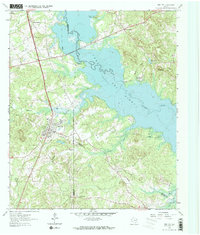
1962 Map of Ore City
USGS Topo · Published 1973About this map
Ore City serves as the focal point of this 1962 survey, situated at the crossroads of early East Texas transportation routes. The landscape is defined by the expansive Lake O' the Pines, which floods the basin of Big Cypress Creek and Cypress Creek. The map documents the region's rural infrastructure just as modern recreational and water management projects were reshaping the land, evidenced by the presence of Warners Landing Campgrounds and County Park Campgrounds.
Find a feature on this map
29 named features on this map. Tap any name to fly to it.
Don’t see what you’re looking for? This feature index may not catch every label — zoom into the map to look around manually.
Map Details
Editions of this 1962 Ore City Map
Other maps of this area

1956 · Tyler
USGS Topo · 1:250,000

1960 · Coffeeville
USGS Topo · 1:24,000

1960 · Glenwood
USGS Topo · 1:24,000

1960 · La Fayette
USGS Topo · 1:24,000

1961 · Lassater
USGS Topo · 1:24,000

1961 · Harleton
USGS Topo · 1:24,000

1962 · Ashland
USGS Topo · 1:24,000

1962 · Avinger
USGS Topo · 1:24,000

1962 · Ore City
USGS Topo · 1:24,000

1962 · Lone Star
USGS Topo · 1:24,000