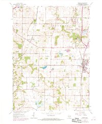
1961 Map of Oregon
USGS Topo · Published 1970About this map
The agrarian landscape of southern Dane County appears here during a period of transition as Fitchburg and Oregon began to expand along their respective rail corridors. The Illinois Central and the Chicago and North Western railroads define the movement through this region, connecting small crossroads like Oak Hall and Story to the wider state. Significant institutional footprints are visible, notably the Wisconsin School for Girls and the Oregon State Farm, which occupied large tracts of land near the village limits.
Find a feature on this map
34 named features on this map. Tap any name to fly to it.
Don’t see what you’re looking for? This feature index may not catch every label — zoom into the map to look around manually.
Map Details
Editions of this 1961 Oregon Map
4 editions found
Other maps of this area

1889 · Evansville
USGS Topo · 1:62,500

1890 · Madison
USGS Topo · 1:62,500

1892 · Madison
USGS Topo · 1:62,500

1894 · Evansville
USGS Topo · 1:62,500

1904 · Madison
USGS Topo · 1:62,500

1906 · Evansville
USGS Topo · 1:62,500

1906 · Madison
USGS Topo · 1:62,500

1907 · Cross Plains
USGS Topo · 1:62,500

1909 · Cross Plains
USGS Topo · 1:62,500

1923 · New Glarus
USGS Topo · 1:62,500