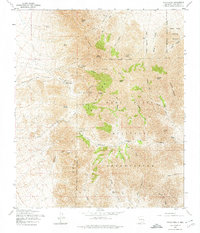
1955 Map of Organ Peak
USGS Topo · Published 1974About this map
Organ Peak and the high spires of the Organ Mountains dominate this mid-century topographic survey of the New Mexico landscape. The era’s intersection of tourism, industry, and defense is visible in the presence of Hayner Resort and the nearby Modoc Mine, while the vast eastern portion of the sheet is defined by the Fort Bliss Military Reservation and the White Sands Proving Ground. These military boundaries hem in the dramatic rock formations of The Needles and The Narrows, illustrating how post-war federal land use shaped the access and development of this high-desert terrain.
Find a feature on this map
51 named features on this map. Tap any name to fly to it.
Don’t see what you’re looking for? This feature index may not catch every label — zoom into the map to look around manually.
Map Details
Editions of this 1955 Organ Peak Map
Other maps of this area

1891 · Las Cruces
USGS Topo · 1:125,000

1893 · Las Cruces
USGS Topo · 1:125,000

1940 · Newman
USGS Topo · 1:62,500

1941 · Organ Peak
USGS Topo · 1:62,500

1943 · La Mesa
USGS Topo · 1:62,500

1943 · Parker Lake
USGS Topo · 1:62,500

1943 · Newman
USGS Topo · 1:62,500

1943 · Organ Peak
USGS Topo · 1:62,500

1948 · Davies Tank
USGS Topo · 1:24,000

1948 · Newman NW
USGS Topo · 1:24,000