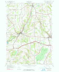
1943 Map of Oriskany Falls
USGS Topo · Published 1990About this map
The New York Ontario and Western railroad corridor shapes the industrial and transit landscape of this central New York region in the early 1940s. Centered on the village of Oriskany Falls and the borough of Waterville, the map details a settled agricultural valley defined by Oriskany Creek and the southern reaches of Ninemile Swamp. Family-named crossroads like Gibbons Corners and Conger Corners anchor a network of rural routes connecting historic hamlets such as Forge Hollow and Deansboro.
Find a feature on this map
43 named features on this map. Tap any name to fly to it.
Don’t see what you’re looking for? This feature index may not catch every label — zoom into the map to look around manually.
Map Details
Editions of this 1943 Oriskany Falls Map
3 editions found
Other maps of this area

1895 · Oriskany
USGS Topo · 1:62,500

1895 · Oneida
USGS Topo · 1:62,500

1898 · Oneida
USGS Topo · 1:62,500

1898 · Oriskany
USGS Topo · 1:62,500

1902 · Morrisville
USGS Topo · 1:62,500

1902 · Oneida
USGS Topo · 1:62,500

1907 · Sangerfield
USGS Topo · 1:62,500

1939 · Oneida
USGS Topo · 1:62,500

1943 · Hubbardsville
USGS Topo · 1:24,000

1943 · Cassville
USGS Topo · 1:24,000