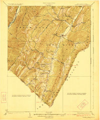
1923 Map of Orkney Springs
USGS Topo · Published 1923About this map
Lost River carves a narrow valley through the high ridges of Hardy County during the early 1920s, anchoring a landscape defined by small mountain gaps and isolated homesteads. The settlement pattern follows the valley floor, connecting Lost City and Mathias via a network of rural schools such as the Bowman School and Shoemaker School. The eastern boundary is marked by the National Forest, while the western edge reveals industrial activity with the Lumber R.R. following the Moorefield River near Elkhorn Mtn.
Find a feature on this map
65 named features on this map. Tap any name to fly to it.
Don’t see what you’re looking for? This feature index may not catch every label — zoom into the map to look around manually.
Map Details
Editions of this 1923 Orkney Springs Map
2 editions found

Other maps of this area

1891 · Romney
USGS Topo · 1:125,000

1892 · Franklin
USGS Topo · 1:125,000

1892 · Woodstock
USGS Topo · 1:125,000

1895 · Piedmont
USGS Topo · 1:125,000

1896 · Franklin
USGS Topo · 1:125,000

1920 · Petersburg
USGS Topo · 1:48,000

1920 · Moorefield
USGS Topo · 1:62,500

1921 · Orkney Springs
USGS Topo · 1:48,000

1921 · Petersburg
USGS Topo · 1:48,000

1921 · Greenland Gap
USGS Topo · 1:62,500