
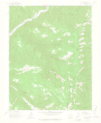
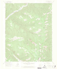
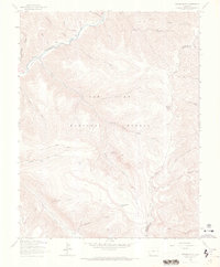
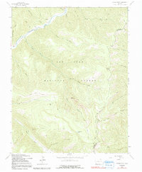
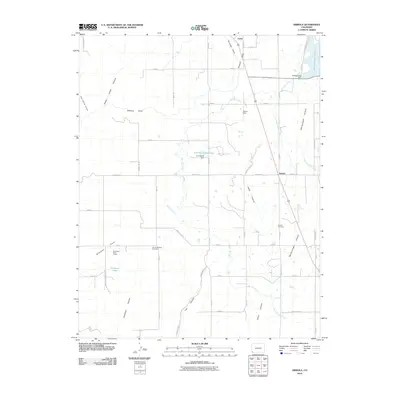
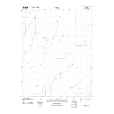
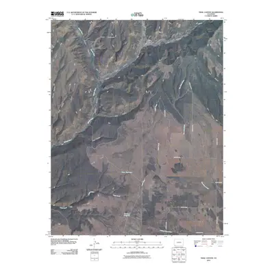
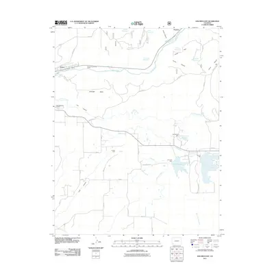
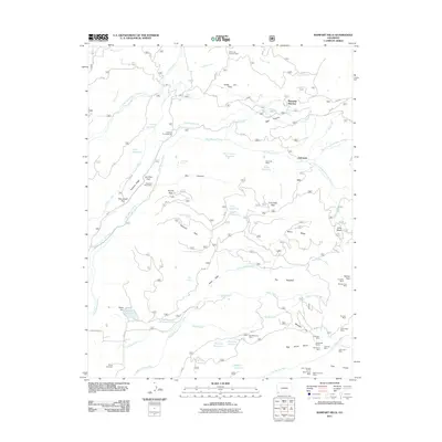
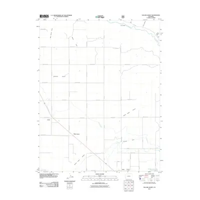
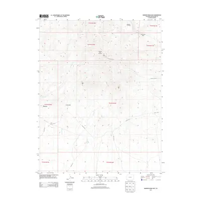
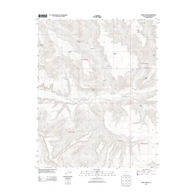
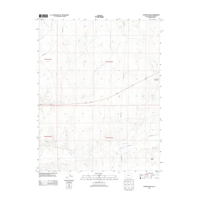
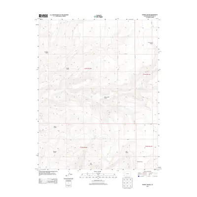
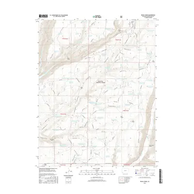
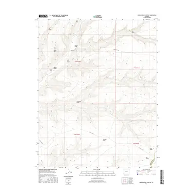
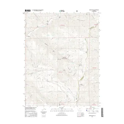
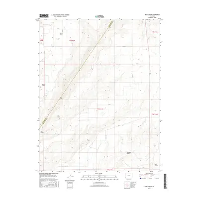
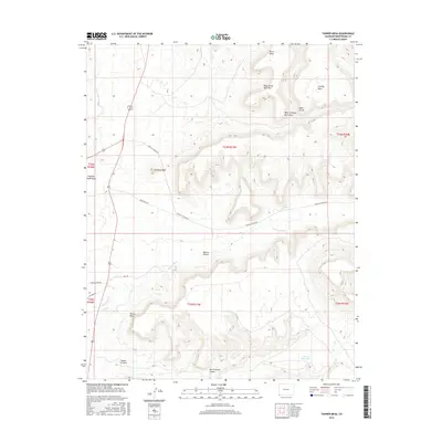
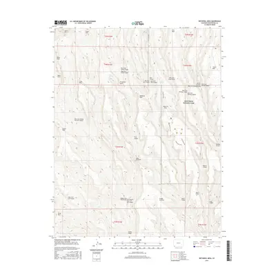
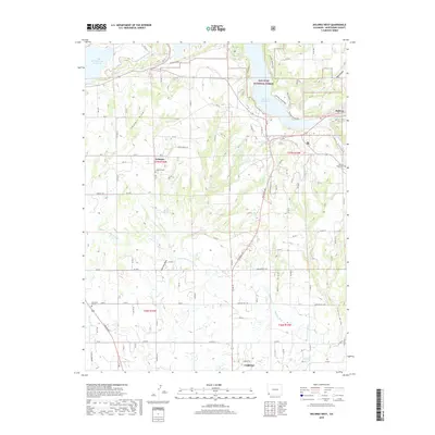
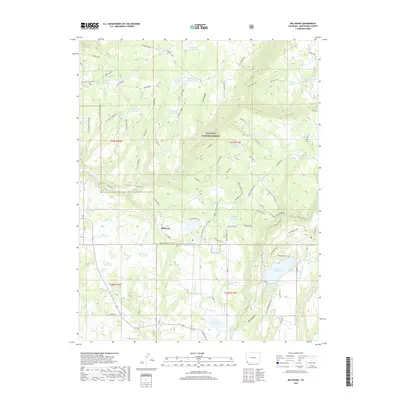
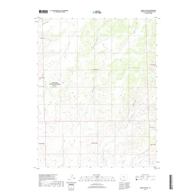
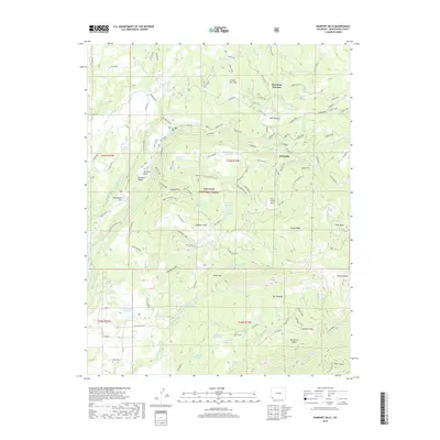
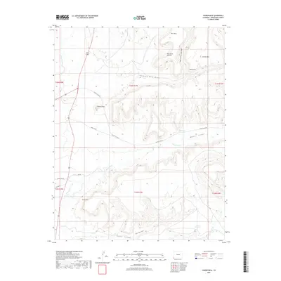
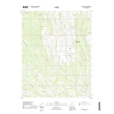
1963 Map of Orphan Butte
USGS Topo · Published 1991About this map
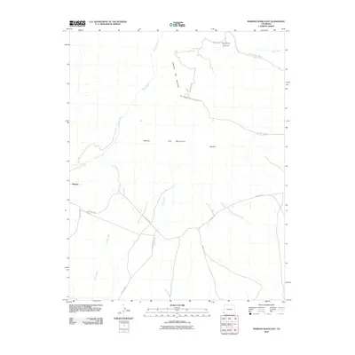
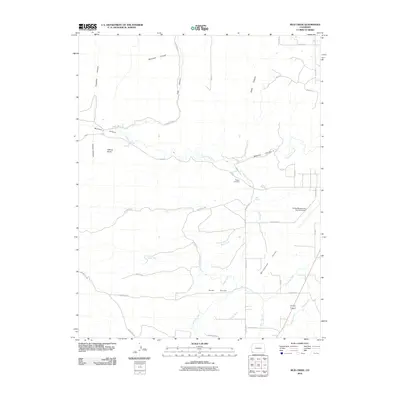
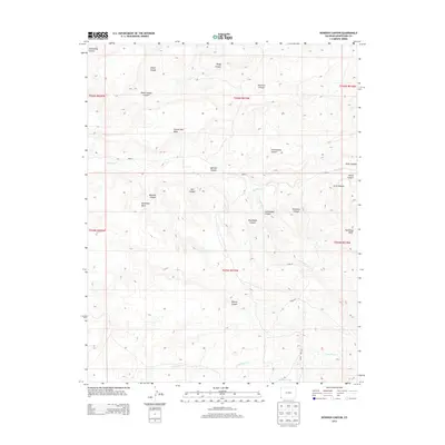
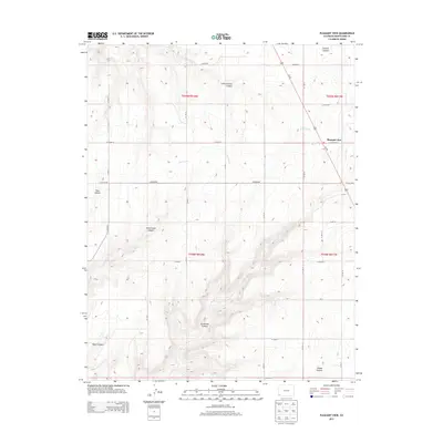
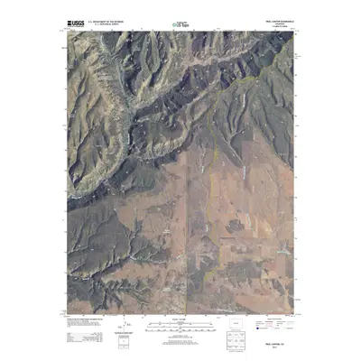
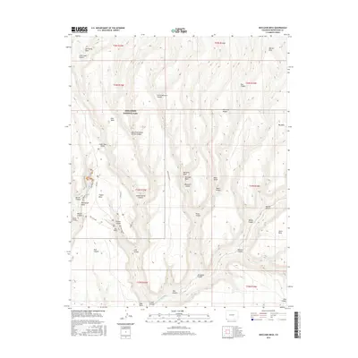
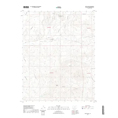
The Dolores River cuts through the northwest corner of this terrain, marking a corridor once utilized by the Old RR Grade. This 1963 survey of the San Juan National Forest reveals a landscape defined by its network of high-elevation trails and seasonal drainage paths like School House Draw and Roaring Forks Creek. The Truelson Ranch stands as the primary namesake settlement in a region otherwise characterized by isolated landmarks such as Orphan Butte and the oddly named Cape of Good Hope. Evidence of the local livestock economy is clear from the established Lost Canyon Stock Driveway, while the presence of Grindstone Lake and numerous pack trails suggests a history of resource management and early backcountry access between Montezuma and La Plata counties.
Find a feature on this map
34 named features on this map. Tap any name to fly to it.
Don’t see what you’re looking for? This feature index may not catch every label — zoom into the map to look around manually.
Map Details
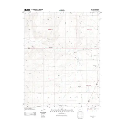
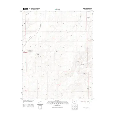
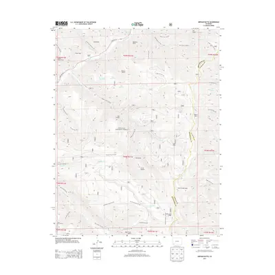
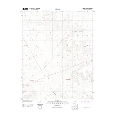
Editions of this 1963 Orphan Butte Map
6 editions found

Historical Maps of La Plata County Through Time
191 maps found

1912 Soda Canyon
Montezuma County, CO

1915 Soda Canyon
Montezuma County, CO

1957 Cedar 3 SW
Montezuma County, CO

1957 Moqui NW
Montezuma County, CO

1957 Moqui SE
Montezuma County, CO

1957 Moqui SW
Montezuma County, CO

1958 Cortez SW
Montezuma County, CO

1958 Sentinel Peak NE
Montezuma County, CO

1958 Sentinel Peak NW
Montezuma County, CO
1963 Orphan Butte
Montezuma County, CO

1963 Rampart Hills
Montezuma County, CO

1963 Stoner
Montezuma County, CO

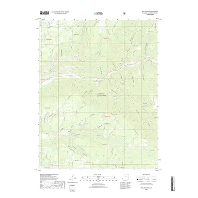
1963 Wallace Ranch
Montezuma County, CO

1965 Arriola
Montezuma County, CO

1965 Boggy Draw
Montezuma County, CO

1965 Dolores East
Montezuma County, CO

1965 Dolores West
Montezuma County, CO

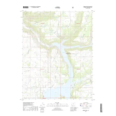
1965 Millwood
Montezuma County, CO

1965 Pleasant View
Montezuma County, CO

1965 Point Lookout
Montezuma County, CO

1965 Trimble Point
Montezuma County, CO

1965 Woods Canyon
Montezuma County, CO

1965 Yellow Jacket
Montezuma County, CO

1966 Greasewood Canyon
Montezuma County, CO

1966 Moqui Canyon
Montezuma County, CO

1966 Sentinel Peak SE
Montezuma County, CO

1966 Sentinel Peak SW
Montezuma County, CO

1966 Tanner Mesa
Montezuma County, CO

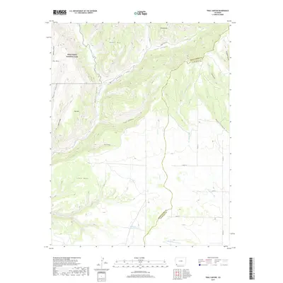
1966 Trail Canyon
Montezuma County, CO

1966 Wetherill Mesa
Montezuma County, CO

1967 Moccasin Mesa
Montezuma County, CO

1972 Cortez SW
Montezuma County, CO

1979 Battle Rock
Montezuma County, CO

1979 Bowdish Canyon
Montezuma County, CO

1979 Mariano Wash East
Montezuma County, CO

1979 Mariano Wash West
Montezuma County, CO

1979 Mud Creek
Montezuma County, CO

1979 Negro Canyon
Montezuma County, CO

1979 Ruin Canyon
Montezuma County, CO

1993 Boggy Draw
Montezuma County, CO

1993 Trimble Point
Montezuma County, CO

1994 Arriola
Montezuma County, CO

1994 Negro Canyon
Montezuma County, CO

1994 Pleasant View
Montezuma County, CO

1994 Ruin Canyon
Montezuma County, CO

1994 Woods Canyon
Montezuma County, CO
2010 Arriola
Montezuma County, CO
2010 Battle Rock
Montezuma County, CO
2010 Bowdish Canyon
Montezuma County, CO
2010 Greasewood Canyon
Montezuma County, CO
2010 Mariano Wash East
Montezuma County, CO
2010 Mariano Wash West
Montezuma County, CO
2010 Moccasin Mesa
Montezuma County, CO
2010 Moqui Canyon
Montezuma County, CO
2010 Mud Creek
Montezuma County, CO
2010 Negro Canyon
Montezuma County, CO
2010 Pleasant View
Montezuma County, CO
2010 Point Lookout
Montezuma County, CO
2010 Ruin Canyon
Montezuma County, CO
2010 Sentinel Peak SE
Montezuma County, CO
2010 Sentinel Peak SW
Montezuma County, CO
2010 Tanner Mesa
Montezuma County, CO
2010 Trail Canyon
Montezuma County, CO
2010 Wetherill Mesa
Montezuma County, CO
2010 Woods Canyon
Montezuma County, CO
2011 Boggy Draw
Montezuma County, CO
2011 Dolores East
Montezuma County, CO
2011 Dolores West
Montezuma County, CO
2011 Millwood
Montezuma County, CO
2011 Orphan Butte
Montezuma County, CO
2011 Rampart Hills
Montezuma County, CO
2011 Stoner
Montezuma County, CO
2011 Trimble Point
Montezuma County, CO
2011 Wallace Ranch
Montezuma County, CO
2011 Yellow Jacket
Montezuma County, CO
2013 Arriola
Montezuma County, CO
2013 Battle Rock
Montezuma County, CO
2013 Boggy Draw
Montezuma County, CO
2013 Bowdish Canyon
Montezuma County, CO
2013 Dolores East
Montezuma County, CO
2013 Dolores West
Montezuma County, CO
2013 Greasewood Canyon
Montezuma County, CO
2013 Mariano Wash East
Montezuma County, CO
2013 Mariano Wash West
Montezuma County, CO
2013 Millwood
Montezuma County, CO
2013 Moccasin Mesa
Montezuma County, CO
2013 Moqui Canyon
Montezuma County, CO
2013 Mud Creek
Montezuma County, CO
2013 Negro Canyon
Montezuma County, CO
2013 Orphan Butte
Montezuma County, CO
2013 Pleasant View
Montezuma County, CO
2013 Point Lookout
Montezuma County, CO
2013 Rampart Hills
Montezuma County, CO
2013 Ruin Canyon
Montezuma County, CO
2013 Sentinel Peak SE
Montezuma County, CO
2013 Sentinel Peak SW
Montezuma County, CO
2013 Stoner
Montezuma County, CO
2013 Tanner Mesa
Montezuma County, CO
2013 Trail Canyon
Montezuma County, CO
2013 Trimble Point
Montezuma County, CO
2013 Wallace Ranch
Montezuma County, CO
2013 Wetherill Mesa
Montezuma County, CO
2013 Woods Canyon
Montezuma County, CO
2013 Yellow Jacket
Montezuma County, CO
2016 Arriola
Montezuma County, CO
2016 Battle Rock
Montezuma County, CO
2016 Boggy Draw
Montezuma County, CO
2016 Bowdish Canyon
Montezuma County, CO
2016 Dolores East
Montezuma County, CO
2016 Dolores West
Montezuma County, CO
2016 Greasewood Canyon
Montezuma County, CO
2016 Mariano Wash East
Montezuma County, CO
2016 Mariano Wash West
Montezuma County, CO
2016 Millwood
Montezuma County, CO
2016 Moccasin Mesa
Montezuma County, CO
2016 Moqui Canyon
Montezuma County, CO
2016 Mud Creek
Montezuma County, CO
2016 Negro Canyon
Montezuma County, CO
2016 Orphan Butte
Montezuma County, CO
2016 Pleasant View
Montezuma County, CO
2016 Point Lookout
Montezuma County, CO
2016 Rampart Hills
Montezuma County, CO
2016 Ruin Canyon
Montezuma County, CO
2016 Sentinel Peak SE
Montezuma County, CO
2016 Sentinel Peak SW
Montezuma County, CO
2016 Stoner
Montezuma County, CO
2016 Tanner Mesa
Montezuma County, CO
2016 Trail Canyon
Montezuma County, CO
2016 Trimble Point
Montezuma County, CO
2016 Wallace Ranch
Montezuma County, CO
2016 Wetherill Mesa
Montezuma County, CO
2016 Woods Canyon
Montezuma County, CO
2016 Yellow Jacket
Montezuma County, CO
2019 Arriola
Montezuma County, CO
2019 Battle Rock
Montezuma County, CO
2019 Boggy Draw
Montezuma County, CO
2019 Bowdish Canyon
Montezuma County, CO
2019 Dolores East
Montezuma County, CO
2019 Dolores West
Montezuma County, CO
2019 Greasewood Canyon
Montezuma County, CO
2019 Mariano Wash East
Montezuma County, CO
2019 Mariano Wash West
Montezuma County, CO
2019 Millwood
Montezuma County, CO
2019 Moccasin Mesa
Montezuma County, CO
2019 Moqui Canyon
Montezuma County, CO
2019 Mud Creek
Montezuma County, CO
2019 Negro Canyon
Montezuma County, CO
2019 Orphan Butte
Montezuma County, CO
2019 Pleasant View
Montezuma County, CO
2019 Point Lookout
Montezuma County, CO
2019 Rampart Hills
Montezuma County, CO

2019 Ruin Canyon
Montezuma County, CO
2019 Sentinel Peak SE
Montezuma County, CO
2019 Sentinel Peak SW
Montezuma County, CO
2019 Stoner
Montezuma County, CO
2019 Tanner Mesa
Montezuma County, CO
2019 Trail Canyon
Montezuma County, CO
2019 Trimble Point
Montezuma County, CO
2019 Wallace Ranch
Montezuma County, CO
2019 Wetherill Mesa
Montezuma County, CO
2019 Woods Canyon
Montezuma County, CO
2019 Yellow Jacket
Montezuma County, CO

2022 Arriola
Montezuma County, CO

2022 Battle Rock
Montezuma County, CO

2022 Boggy Draw
Montezuma County, CO

2022 Bowdish Canyon
Montezuma County, CO

2022 Dolores East
Montezuma County, CO

2022 Dolores West
Montezuma County, CO

2022 Greasewood Canyon
Montezuma County, CO

2022 Mariano Wash East
Montezuma County, CO

2022 Mariano Wash West
Montezuma County, CO

2022 Millwood
Montezuma County, CO

2022 Moccasin Mesa
Montezuma County, CO

2022 Moqui Canyon
Montezuma County, CO

2022 Mud Creek
Montezuma County, CO

2022 Negro Canyon
Montezuma County, CO

2022 Orphan Butte
Montezuma County, CO

2022 Pleasant View
Montezuma County, CO

2022 Point Lookout
Montezuma County, CO

2022 Rampart Hills
Montezuma County, CO

2022 Sentinel Peak SE
Montezuma County, CO

2022 Sentinel Peak SW
Montezuma County, CO

2022 Stoner
Montezuma County, CO

2022 Tanner Mesa
Montezuma County, CO

2022 Trail Canyon
Montezuma County, CO

2022 Trimble Point
Montezuma County, CO

2022 Wallace Ranch
Montezuma County, CO

2022 Wetherill Mesa
Montezuma County, CO

2022 Woods Canyon
Montezuma County, CO

2022 Yellow Jacket
Montezuma County, CO

2023 Ruin Canyon
Montezuma County, CO