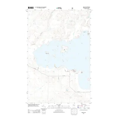
2013 Map of Orr SW
USGS Topo · Published 2013About this map
Pelican Lake dominates this portion of Saint Louis County, its shoreline intricate with named points and islands. Much of the land is part of the Superior Natl Forest, characterized by a complex network of waterways including Swan Creek, Portage Cr, and Gabrielson Lake. The map details the transition from water to forest, showing the recreational development at the Aspen Resort and Campground and the seasonal access provided by local routes like Nett Lake Rd and Town Line Rd.
Find a feature on this map
27 named features on this map. Tap any name to fly to it.
Don’t see what you’re looking for? This feature index may not catch every label — zoom into the map to look around manually.
Map Details
Editions of this 2013 Orr SW Map
This is the sole edition of this map. No revisions or reprints were ever made.
Other maps of this area
1954 · Hibbing
USGS Topo · 1:250,000

1954 · International Falls
USGS Topo · 1:250,000
1957 · Hibbing
USGS Topo · 1:250,000

1957 · International Falls
USGS Topo · 1:250,000

1958 · International Falls
USGS Topo · 1:250,000
1958 · Hibbing
USGS Topo · 1:250,000
1964 · Hibbing
USGS Topo · 1:250,000
1964 · Gheen NW
USGS Topo · 1:24,000
1964 · Gheen
USGS Topo · 1:24,000
1968 · Ash Lake
USGS Topo · 1:24,000