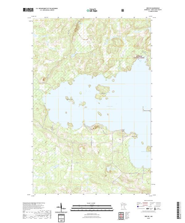
2022 Map of Orr SW
USGS Topo · Published 2022About this map
Pelican Lake dominates this northern Minnesota landscape, where the waters are punctuated by distinctive landmarks like Big Island and Baileys Island. The map shows a region defined by its transition from open water to the dense woods of the Superior National Forest, which covers the northeastern portion of the sheet. Numerous smaller water bodies, including Rabbit Lake and Gabrielson Lake, are connected by a network of drainage features such as Portage Cr and Swan Cr. Human activity is primarily limited to the shoreline, marked by named points like Eagle Point and Elliott Point, and a grid of rural roads. These routes, such as Co Rd 539 and Range Line Rd, provide access to the various bays and peninsulas that characterize this lake-heavy environment in St. Louis County.
Find a feature on this map
40 named features on this map. Tap any name to fly to it.
Don’t see what you’re looking for? This feature index may not catch every label — zoom into the map to look around manually.
Map Details
Editions of this 2022 Orr SW Map
This is the sole edition of this map. No revisions or reprints were ever made.
Other maps of this area

1954 · Hibbing
USGS Topo · 1:250,000

1954 · International Falls
USGS Topo · 1:250,000

1957 · Hibbing
USGS Topo · 1:250,000

1957 · International Falls
USGS Topo · 1:250,000

1958 · International Falls
USGS Topo · 1:250,000

1958 · Hibbing
USGS Topo · 1:250,000

1964 · Hibbing
USGS Topo · 1:250,000

1964 · Gheen NW
USGS Topo · 1:24,000

1964 · Gheen
USGS Topo · 1:24,000

1968 · Ash Lake
USGS Topo · 1:24,000