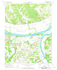
1967 Map of Osage City
USGS Topo · Published 1968About this map
The confluence of the Missouri River and the Osage River dominates this mid-century landscape, where river-bottom agriculture meets the rising bluffs of central Missouri. This area is a significant corridor for transit, evidenced by the parallel tracks of the Missouri Pacific and Missouri Kansas Texas railroads. Near the river junction, Osage City and the historic Cote Sans Dessein area sit across the water from one another, marking old riverfront settlements. Inland, the landscape transitions into the hills of Summit and Liberty townships, dotted with small communities like Taos and Schubert. Local genealogy is well-documented through numerous rural landmarks, including Barkersville Ch, St Johns Ch, and several family burial grounds such as Link Cem and Thorp Cem. The presence of the Algoa Reformatory and numerous limestone quarries along the river bluffs indicates the industrial and institutional character of the land south of the Missouri.
Find a feature on this map
42 named features on this map. Tap any name to fly to it.
Don’t see what you’re looking for? This feature index may not catch every label — zoom into the map to look around manually.
Map Details
Editions of this 1967 Osage City Map
4 editions found
Other maps of this area

1886 · Jefferson City
USGS Topo · 1:125,000

1888 · Tuscumbia
USGS Topo · 1:125,000

1890 · Fulton
USGS Topo · 1:125,000

1894 · Tuscumbia
USGS Topo · 1:125,000

1894 · Jefferson City
USGS Topo · 1:125,000

1934 · Linn
USGS Topo · 1:48,000

1939 · Jefferson City
USGS Topo · 1:24,000

1939 · Jefferson City
USGS Topo · 1:62,500

1942 · Jefferson City
USGS Topo · 1:62,500

1942 · Linn
USGS Topo · 1:62,500