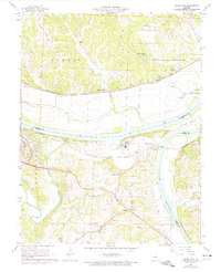
1967 Map of Osage City
USGS Topo · Published 1975About this map
The Missouri River corridor serves as the primary geographical axis for this 1960s survey, where the Osage River joins from the south. The convergence of these major waterways defined the early industrial and agricultural development of the region, visible here in the numerous quarries along the bluffs and the presence of the Algoa Reformatory overlooking the water. Transportation networks reflect this river-valley economy, with the Missouri Kansas Texas railroad skirting the northern bank through Wainwright and the Missouri Pacific line serving the southern shore near Osage City.
Find a feature on this map
46 named features on this map. Tap any name to fly to it.
Don’t see what you’re looking for? This feature index may not catch every label — zoom into the map to look around manually.
Map Details
Editions of this 1967 Osage City Map
4 editions found
Other maps of this area

1886 · Jefferson City
USGS Topo · 1:125,000

1888 · Tuscumbia
USGS Topo · 1:125,000

1890 · Fulton
USGS Topo · 1:125,000

1894 · Tuscumbia
USGS Topo · 1:125,000

1894 · Jefferson City
USGS Topo · 1:125,000

1934 · Linn
USGS Topo · 1:48,000

1939 · Jefferson City
USGS Topo · 1:24,000

1939 · Jefferson City
USGS Topo · 1:62,500

1942 · Jefferson City
USGS Topo · 1:62,500

1942 · Linn
USGS Topo · 1:62,500