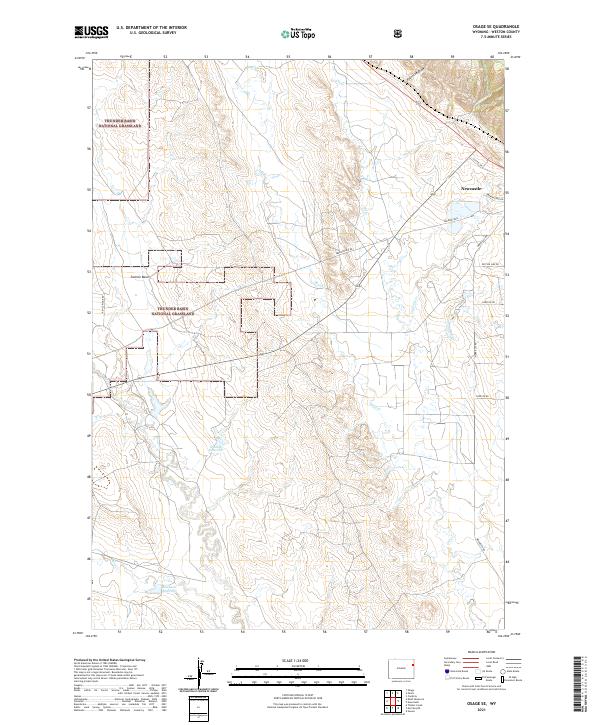
2021 Map of Osage SE
USGS Topo · Published 2021About this map
Thunder Basin National Grassland encompasses much of this high plains landscape, where complex drainage systems define the local topography. This part of Weston County is characterized by a dense network of seasonal and perennial waterways, including Skull Cr, Beaver Cr, and Oil Cr, which converge across the arid basin. The presence of the Shostak Reservoir and Michaels Reservoir indicates the critical importance of water management for livestock and land use in this open range. Near the settlement of Newcastle, the terrain transitions into named topographic features like Sixmile Basin and Fourmile Draw. The map documents a landscape primarily organized by long-standing rural routes such as Morrissey Rd and Eberspecher Rd, reflecting the ranching and resource-based economy that continues to shape this corner of Wyoming.
Find a feature on this map
23 named features on this map. Tap any name to fly to it.
Don’t see what you’re looking for? This feature index may not catch every label — zoom into the map to look around manually.
Map Details
Editions of this 2021 Osage SE Map
This is the sole edition of this map. No revisions or reprints were ever made.
Other maps of this area

1899 · Newcastle
USGS Topo · 1:125,000

1901 · Newcastle
USGS Topo · 1:125,000

1951 · Owens
USGS Topo · 1:24,000

1951 · Newcastle
USGS Topo · 1:24,000

1951 · Morrisey NE
USGS Topo · 1:24,000

1951 · Osage SE
USGS Topo · 1:24,000

1955 · Newcastle
USGS Topo · 1:250,000

1958 · Newcastle
USGS Topo · 1:250,000
1958 · Newcastle
USGS Topo · 1:62,500
1972 · Pedro
USGS Topo · 1:24,000