
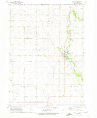
1972 Map of Osage SW
USGS Topo · Published 1974About this map
The Cedar River meanders prominently through this Mitchell County landscape, dictating the placement of early settlements and recreation areas during the early 1970s. The town of St Ansgar sits at the northern edge of the map, while Mitchell occupies a scenic bend in the river to the east, connected by the tracks of the Illinois Central Gulf railroad. This survey reveals a community deeply rooted in its local geography, where public spaces like Halverson Park and Interstate Park leverage the riverside terrain.
Find a feature on this map
23 named features on this map. Tap any name to fly to it.
Don’t see what you’re looking for? This feature index may not catch every label — zoom into the map to look around manually.
Map Details
Editions of this 1972 Osage SW Map
This is the sole edition of this map. No revisions or reprints were ever made.
Other maps of this area

1954 · Mason City
USGS Topo · 1:250,000

1957 · Mason City
USGS Topo · 1:250,000

1958 · Mason City
USGS Topo · 1:250,000

1959 · Mason City
USGS Topo · 1:62,500

1959 · Nora Springs
USGS Topo · 1:24,000

1971 · Orchard
USGS Topo · 1:24,000

1971 · Rudd
USGS Topo · 1:24,000

1972 · Osage
USGS Topo · 1:24,000

1972 · St. Ansgar
USGS Topo · 1:24,000
1972 · Stacyville
USGS Topo · 1:24,000