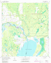
1966 Map of Osceola
USGS Topo · Published 1988About this map
Lake Harney dominates the southern landscape of this mid-century survey, where the St Johns River winds through an intricate network of wetlands and sloughs. The settlement pattern is defined by small outposts such as Farmton, Kalamazoo, and Osceola, which are connected by the Osteen Maytown Road. A significant portion of the northern terrain is dedicated to the Farmton State Wildlife Management Area, reflecting the area's transition into protected conservation land.
Find a feature on this map
33 named features on this map. Tap any name to fly to it.
Don’t see what you’re looking for? This feature index may not catch every label — zoom into the map to look around manually.
Map Details
Editions of this 1966 Osceola Map
4 editions found
Other maps of this area

1949 · Osceola
USGS Topo · 1:24,000

1950 · Maytown
USGS Topo · 1:24,000

1950 · Edgewater
USGS Topo · 1:24,000

1950 · Aurantia
USGS Topo · 1:24,000

1953 · Geneva
USGS Topo · 1:24,000

1955 · Orlando
USGS Topo · 1:250,000

1956 · Oviedo
USGS Topo · 1:24,000

1957 · Orlando
USGS Topo · 1:250,000

1958 · Orlando
USGS Topo · 1:250,000

1962 · Orlando
USGS Topo · 1:250,000