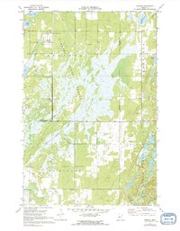
1970 Map of Oshawa
USGS Topo · Published 1991About this map
Badoura State Forest dominates this landscape along the border of Hubbard and Cass counties, reflecting a region deeply managed for timber and conservation in the early 1970s. The presence of the Badoura State Nursery and its associated Badoura Lookout Tower underscores the area's role as a vital center for Minnesota forestry. A complex network of water and wetlands, including Big Swamp Creek and scattered bodies like Mow Lake and Nagel Lake, illustrates the post-glacial topography typical of this timberland.
Find a feature on this map
17 named features on this map. Tap any name to fly to it.
Don’t see what you’re looking for? This feature index may not catch every label — zoom into the map to look around manually.
Map Details
Editions of this 1970 Oshawa Map
2 editions found
Other maps of this area

1919 · Leader
USGS Topo · 1:62,500

1953 · Brainerd
USGS Topo · 1:250,000

1957 · Brainerd
USGS Topo · 1:250,000

1958 · Brainerd
USGS Topo · 1:250,000

1965 · Brainerd
USGS Topo · 1:250,000

1969 · Burgen Lake
USGS Topo · 1:24,000

1970 · Spider Lake
USGS Topo · 1:24,000

1970 · Backus
USGS Topo · 1:24,000

1970 · Hackensack
USGS Topo · 1:24,000
1970 · Bungo Creek
USGS Topo · 1:24,000