
1949 Map of Oslo
USGS Topo · Published 1964About this map
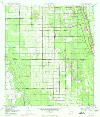
McKee Jungle Gardens stands as a prominent landmark on this 1940s landscape, situated just south of the growing community of Vero Beach. This coastal Florida region is defined by its transition from agricultural citrus groves to early residential and recreational development. The transportation and utility infrastructure of the era is clearly marked, featuring the Florida East Coast railway and various telephone and underground telephone corridors that supported local connectivity. The map also delineates the northern border of St. Lucie County, capturing the small settlements of Oslo and Indrio before they were absorbed by further suburban expansion. Water management is a visible priority for the coastal terrain, evidenced by the presence of the South Canal, which cuts through the low-lying interior to manage the area's drainage and drainage patterns.
Find a feature on this map
10 named features on this map. Tap any name to fly to it.
Don’t see what you’re looking for? This feature index may not catch every label — zoom into the map to look around manually.
Map Details
Editions of this 1949 Oslo Map
3 editions found
Other maps of this area

1948 · Riomar
USGS Topo · 1:24,000

1948 · Indrio
USGS Topo · 1:24,000

1949 · Fort Pierce
USGS Topo · 1:24,000

1949 · Vero Beach
USGS Topo · 1:24,000

1949 · Fort Pierce NW
USGS Topo · 1:24,000

1950 · Riomar
USGS Topo · 1:24,000

1950 · Fort Pierce
USGS Topo · 1:24,000

1950 · Fort Pierce NW
USGS Topo · 1:24,000

1950 · Oslo
USGS Topo · 1:24,000

1950 · Indrio
USGS Topo · 1:24,000