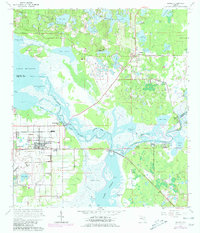
1965 Map of Osteen
USGS Topo · Published 1981About this map
The St Johns River and its intricate network of sloughs and lakes dominate this Central Florida landscape at the boundary of Volusia and Seminole Counties. The river's winding path is flanked by features like Brickyard Slough and Indian Mound Slough, indicating a complex riparian environment before modern drainage altered much of the region. Local settlements are scattered throughout the pine and palm hammocks, including the community of Osteen and the historically significant Indian Mound Village near the river bend.
Find a feature on this map
72 named features on this map. Tap any name to fly to it.
Don’t see what you’re looking for? This feature index may not catch every label — zoom into the map to look around manually.
Map Details
Editions of this 1965 Osteen Map
3 editions found
Other maps of this area

1949 · Osceola
USGS Topo · 1:24,000

1953 · Geneva
USGS Topo · 1:24,000

1955 · Orlando
USGS Topo · 1:250,000

1956 · Oviedo
USGS Topo · 1:24,000

1957 · Orlando
USGS Topo · 1:250,000

1958 · Orlando
USGS Topo · 1:250,000

1962 · Orlando
USGS Topo · 1:250,000

1962 · Casselberry
USGS Topo · 1:24,000
1964 · Orange City
USGS Topo · 1:24,000
1965 · Osteen
USGS Topo · 1:24,000